The monastic complex of Dadivank. General information

Location

Dadivank is located in Artsakh's historical Upper Khachen Province, about 10 kilometers downstream from the confluence of the Trtu (Tartar) River and its tributary Dutkhu, on the river's left bank at the southern foot of a wooded hill. The location is 1100 meters above sea level and 75 meters from Tartar's coast. The ruins of the historic Khut or Khutavan village are situated between the river and the monastery. During the Soviet era, it was also known as Vank. Khutavank is Dadivank's second name. The names of both the monastery and the village are related to the location, as "khut" means "hill" in literary Armenian and Artsakh dialects, meaning that the monastery is situated on a hill. Before the Second Artsakh War, the monastery and village of the same name were part of the Republic of Artsakh's Nor Shahumyan region. Azerbaijan currently occupies both the village and the monastery (Fig. 1).

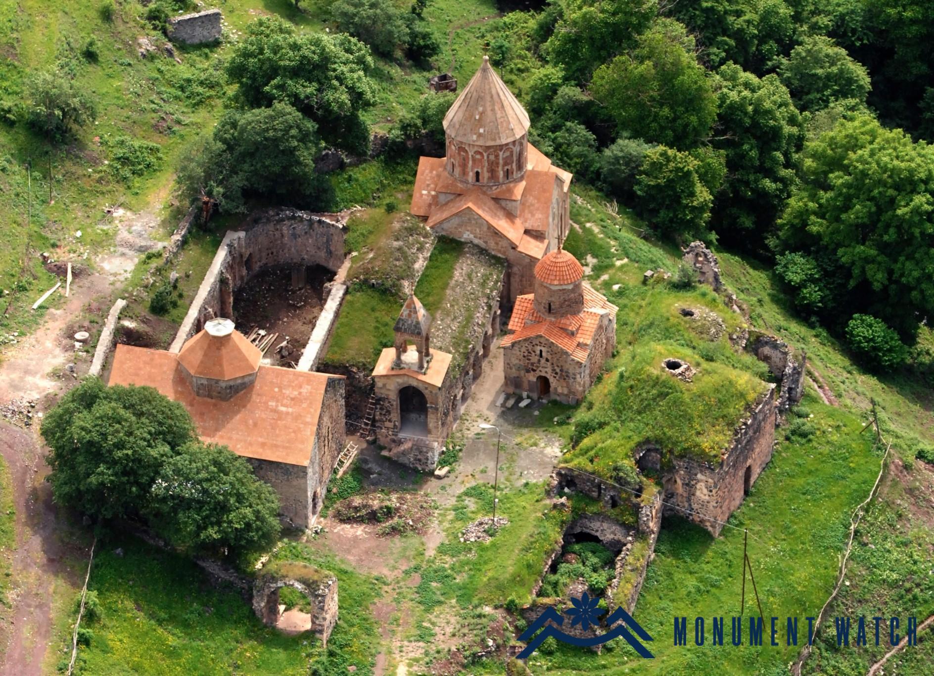
Fig. 1 The general view of the complex, aerial photograph by S. Ayvazyan.

A brief historical overview

Dadivank appears in bibliographic sources for the first time in the 9th century, "...in Khoradzor, known as Dado monastery" (Kaghankatvatsi 1983, 340). It is also known as Dadi, Dadoi, Dadui, Dadei, Tadei, Khuta, and Arakelots in later lithographic and bibliographic sources (Ayvazyan 2015, 6). The monastery's foundation is traditionally linked to the martyrdom of Dadi, a disciple of the apostle Thaddeus. According to legend, he was martyred for spreading Christianity, and a monastery was built on his grave.

There is no available information regarding the monastery's history, construction process, or activities before the 12th century, but it was already a major spiritual and cultural center in the second half of the 12th century. It is mentioned indirectly in the historian's report, which also describes the years 1145-1146, the actions of the Chol commander who came from Persia to punish the Shahap (city head) of Gandzak's rebellion against the Seljuk state: "(Chol) burned down the apostolic holy place known as Dadivank" (Kaghankatvatsi 1983, 353). It is crucial to note that the lords of Khachen also fought against the weakened Seljuk state, and as a consequence, Dadivank, along with many other monasteries and fortresses, was repeatedly damaged and destroyed. That being said, thanks to that struggle, the lords of Khachen gained some political independence in the second half of the 12th century. Dadivank was under the reign of Haterk lords, who were considered supreme rulers and served as their spiritual center at the time. Beginning in the second half of the 12th century, as evidenced by inscriptions carved on the monastery's walls, the religious and secular buildings in the monastery were renovated and new ones were constructed, resulting in the current appearance of the monastery complex (Figs. 2, 3, 4, 5, and 6).

Fig. 2 The view of the complex from the southwest, photo by H. Petrosyan.

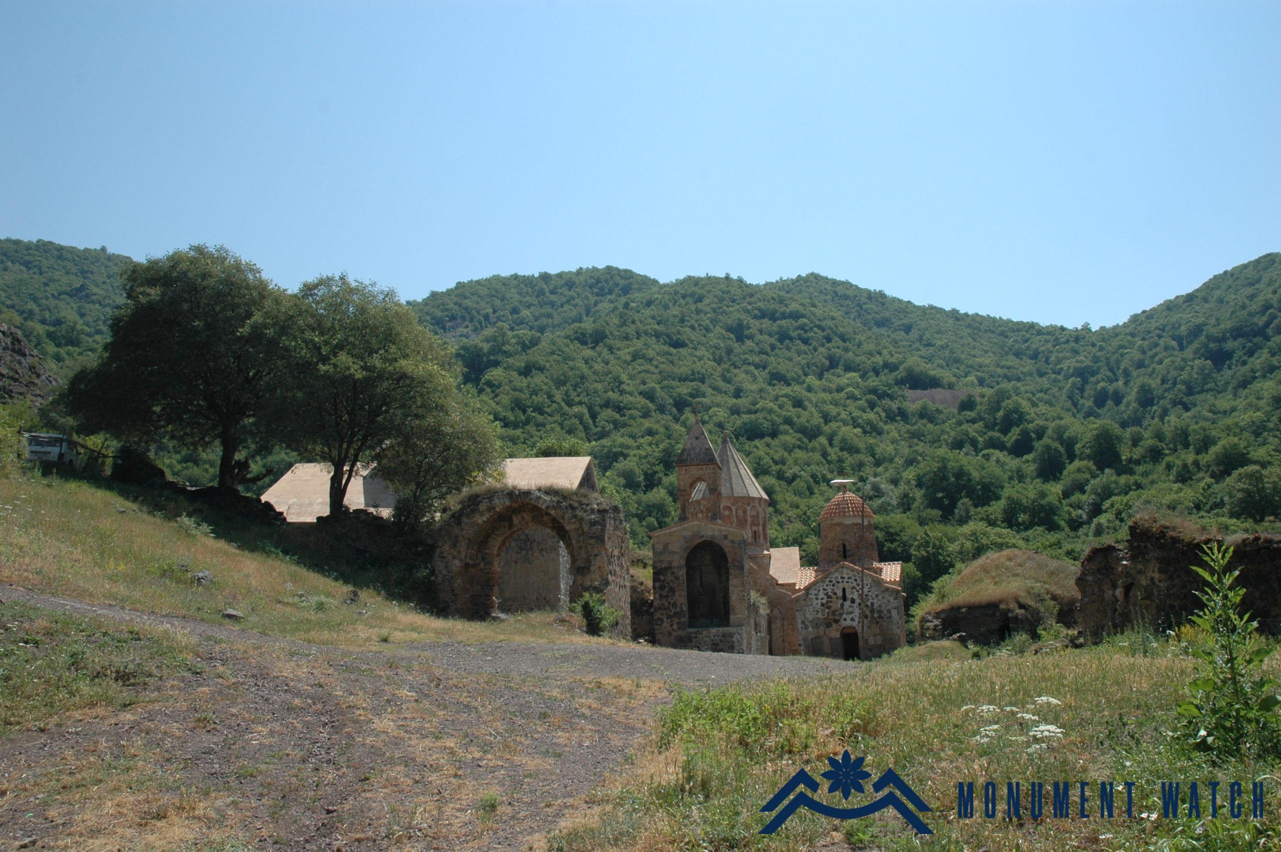
Fig. 3 The view of the complex from the west, photo by H. Petrosyan.

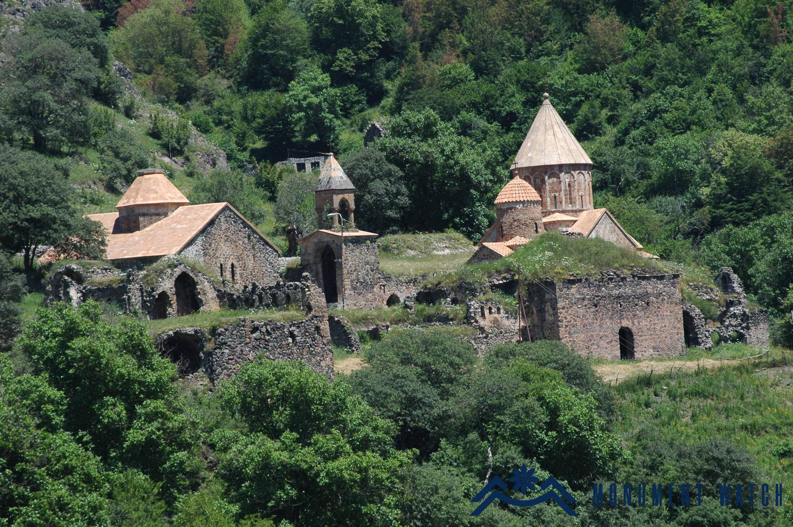
Fig. 4 The view of the complex from the south, photo by H. Petrosyan.

Fig. 5 The inner yard of the church structures, photo by H. Petrosyan.

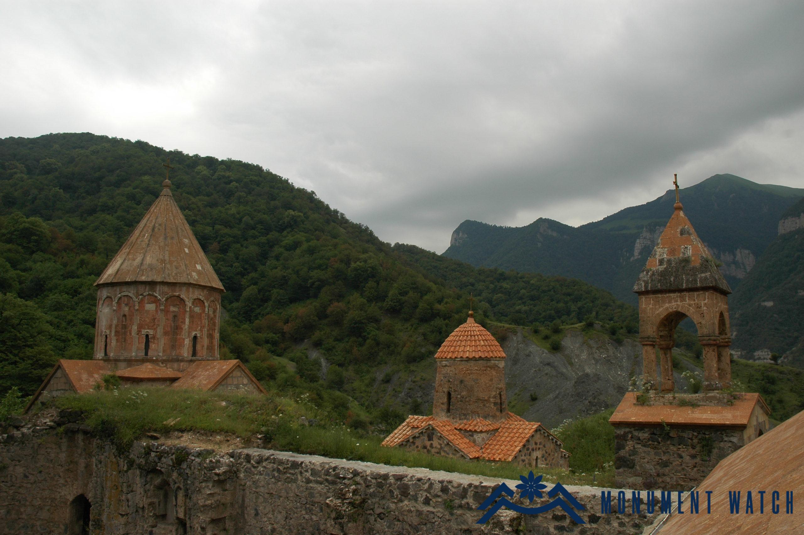
Fig. 6 The view of the domes from the north, photo by H. Petrosyan.

Until the first half of the 17th century, Dadivank had extensive estates and kept the central position of the Patriarch's official seat (Karapetyan 1999, 83). Beginning in the second half of the 17th century, the monastery gradually lost its wealth, dozens of surrounding Armenian villages, and the serving population, until it was dilapidated and uninhabited by the middle of the 19th century. Archbishop Sargis Jalalyants describes the monastery as "ambushed by bandits and robbers of Artsakh province," they kept "some of their livestock and some of their cattle" in elaborate sanctuaries. "The extensive gardens with their barn rooms are already in ruins," he adds, "with only the wild fruit-bearing trees still growing and multiplying" (Jalaleants 1858, 224, 225). Levon Ter-Avetikyan filed a lawsuit against the shepherds who took over the monastery lands at the beginning of the twentieth century. He was able to liberate many country houses from the Turks and Kurds and secure Dadivank's monastic territories. With the establishment of the Soviet regime, Dadivank lost its property and became a temporary residence for Muslim herders who had settled here since the 18th century.

The complex's overall territorial organization

Dadivank is comprised of two large groups of religious and secular monuments that are located on the upper northern and lower southern rising grounds, respectively, and are part of the unified walls (Fig. 7). Outside the walls, there are also separate buildings. The monastery's main entrance is on the west side. It has a single-arched, quartzite-lined opening. The complex's second entrance is on the southwest side, with a smaller and more modest size. The structures are standing, partially destroyed, in an emergency, or in a state of ruin. The churches, courtyards, and bell towers are situated in the northern section, while secular buildings are located in the southern section (Fig. 8).

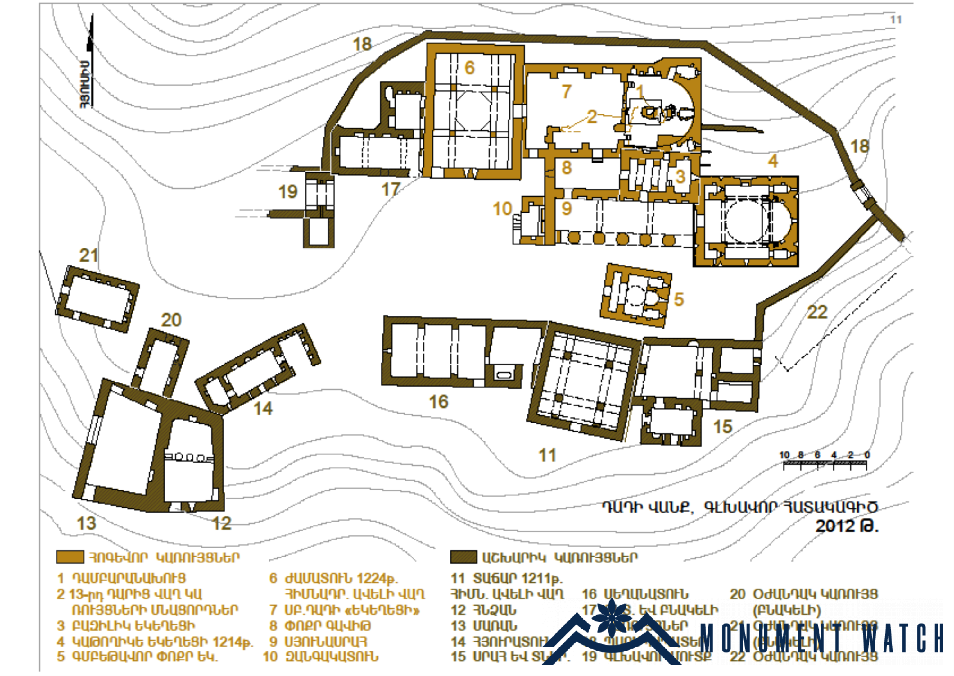
Fig. 7 The complex's general architectural plan, measured by S. Ayvazyan.

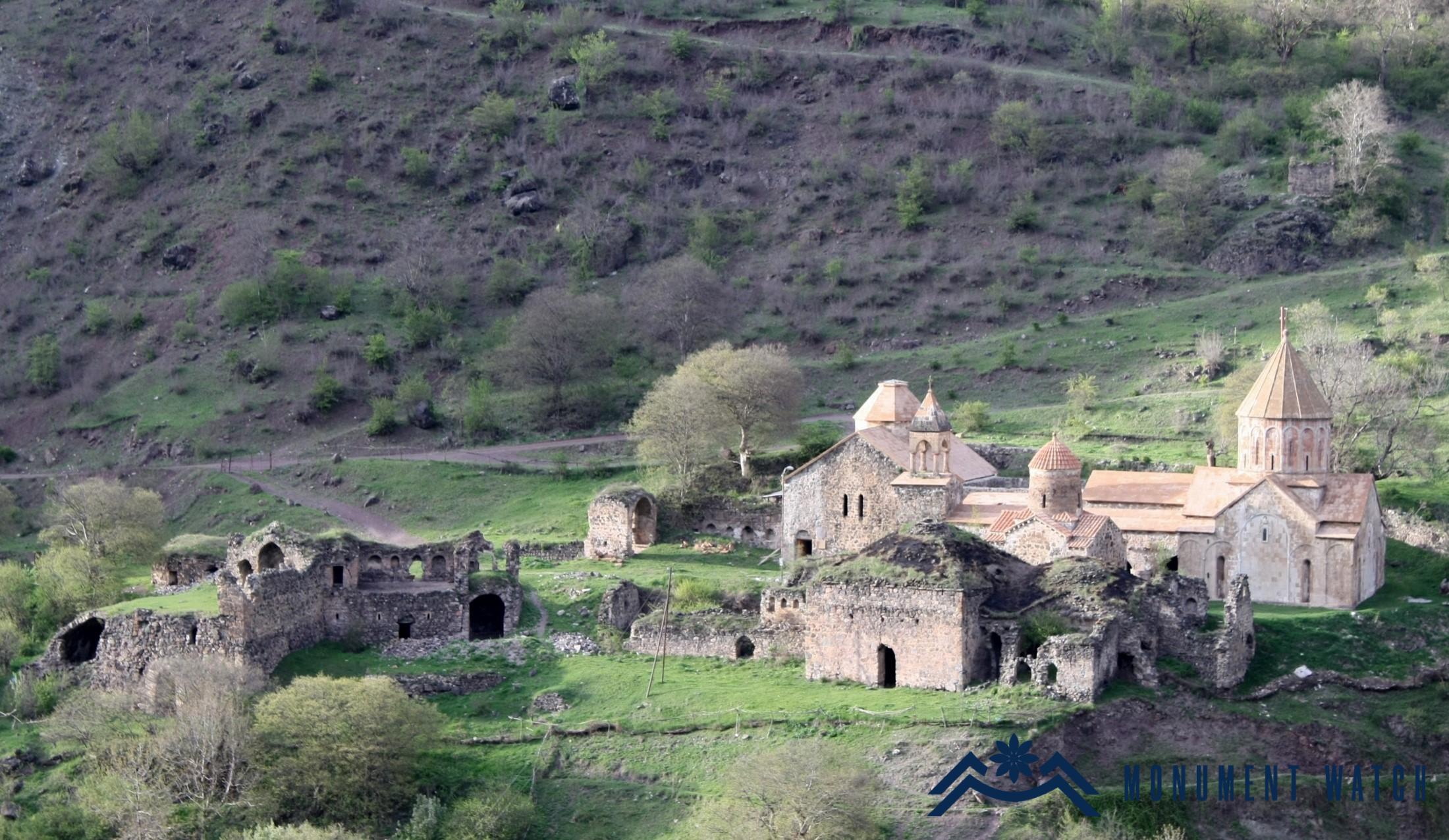
Fig. 8 The general view of the complex from the south, photo by S. Ayvazyan.

Bibliography

  1. Ayvazyan 2015 - Ayvazyan S., Restoration of Dadivank Monastery in 1997–2011, Yerevan, RAA publication.
  2. Kaghankatvatsi 1983 - Movses Kaghankatvatsi, History of Caucasian Albania, NAS RA Publishing House, Yerevan.
  3. Karapetyan 1999 - Karapetyan S., Monuments of Armenian culture in the regions annexed to Soviet Azerbaijan, NAS RA "Gitutyun" publishing house, Yerevan.
  4. Jalalyants 1858 – Jalalyants S., Journey to Greater Armenia, part 2, Tiflis.
The monastic complex of Dadivank. General information
Artsakh