TIGRANAKERT
TIGRANAKERT ARCHAEOLOGICAL SITE: BRIEF INTRODUCTION.
The antique city of Tigranakert is located on the right bank of the Khachenaget River on the slopes of the Vankasar and Tsitssar mountains and the adjacent plains and covers an area of about 1000 hectares with suburbs.
The city was founded at the beginning of the 1st century BC by the king of Armenia Tigranes the Great (95-55 BC) and existed until the middle of the 13th century. Then city was abandoned. The new constructions on the site appeared in the middle of the 18th century.
Tigranakert of Artsakh is the only one among numerous settlements named after Tigranes, the location of which is precise and which is being investigated by archaeologists. As the result of 15 years of archaeological research, a large settlement formed by a Hellenistic advanced fortification system and using its construction techniques appeared. According to the available data, Tigranakert consisted of a large (appx. 6 ha) fortified district, spread over the slope of the Vankasar mountain in the form of artificial terraces, surrounded by powerful walls, with at least four city quarters spread in the plain, cemeteries and large agricultural suburbs. The city was completely built of the local cream limestone.
Through excavations, the Early Christian square with double churches and the remains of a monumental stela with a cross, as well as an Early Christian underground reliquary and a graveyard were opened. Among some thousands of archaeological materials luxury ceramic vessels, Parthian coins, Sasanian seals, 5-7 cc. AD Armenian inscriptions were unearthed.
Main complexes fixed and excavated on the site and the outskirts of the city.
- Fortified district, early 1st century BC.
- Antique quarters, 1st cent. BC – 3rd cent. AD.
- Early Christian square, 5th - 7th cc. AD.
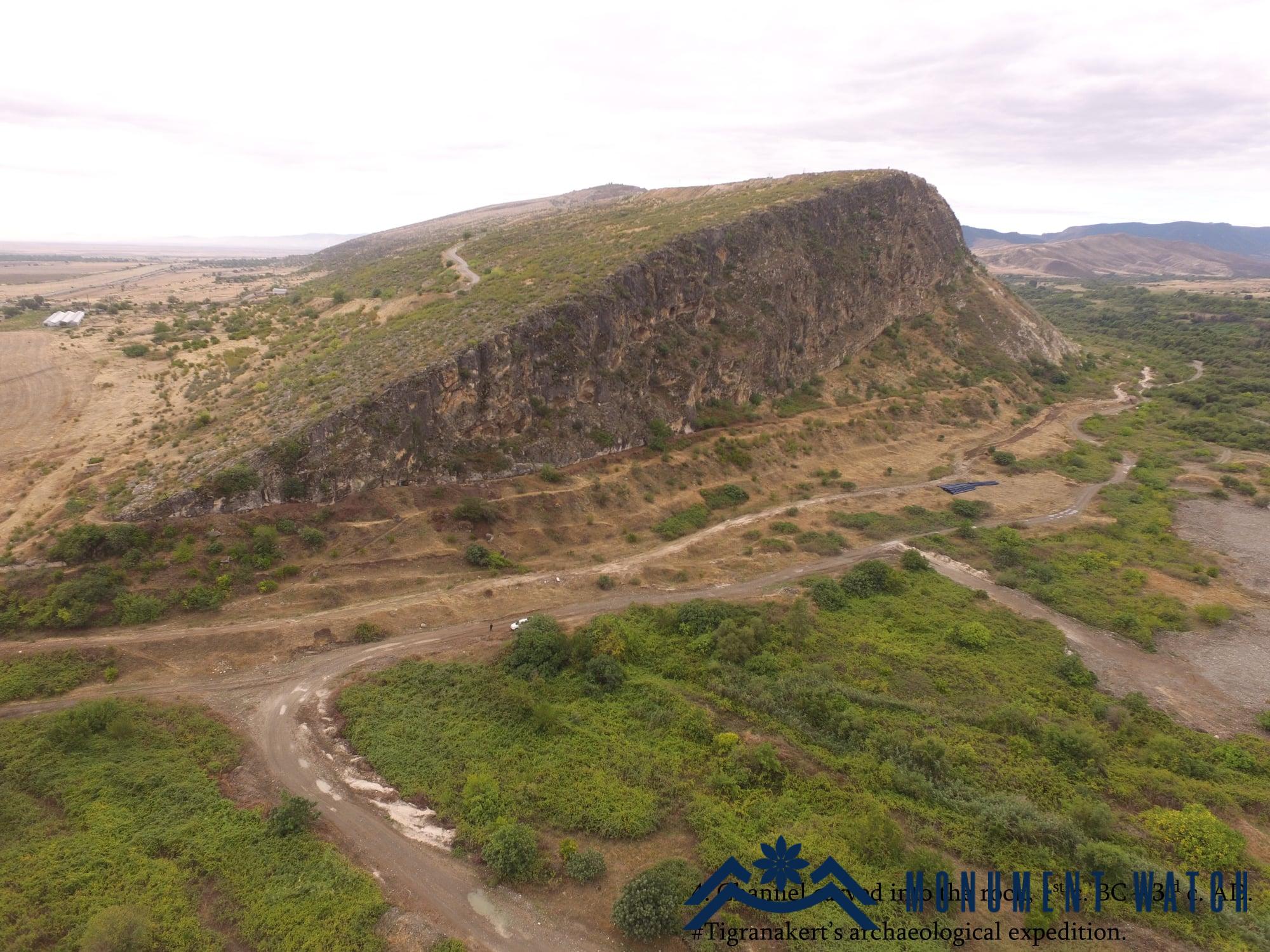
- Channel carved into the rock, 1st cent. BC – 3rd cent. AD.
- Vankasar church, 7th cent. AD.
- Rock cut Christian complex, 5th - 7th cc. AD.
- Tsitssar church and reliquary, 5th -13th cc. AD.
- Late medieval fortress, 18th cent. AD.
- Historical park with springs, a late medieval building (18th cent. AD), and the remains of a pool fountain.
Main coordinates of the complexes
- N 40.0702 E 46.8994
- N 40.0647 E 46.9045
- N 40.04 02,1 E 46. 54 21.5
- N 40.0697 E 46.9041
- N 40. 04 19.7 E 46. 53 13.6
- N 40. 05 40.1 E 46. 53 08.7
- N 40. 03 29.2 E 46. 53 48.4
- N 40. 06 17 E 46. 20 54
- N 40. 04 10 E 46. 50 18


Տիգրանակերտ
Artsakh