The Late Bronze Age Burial Mounds of the Khachenaget Valley
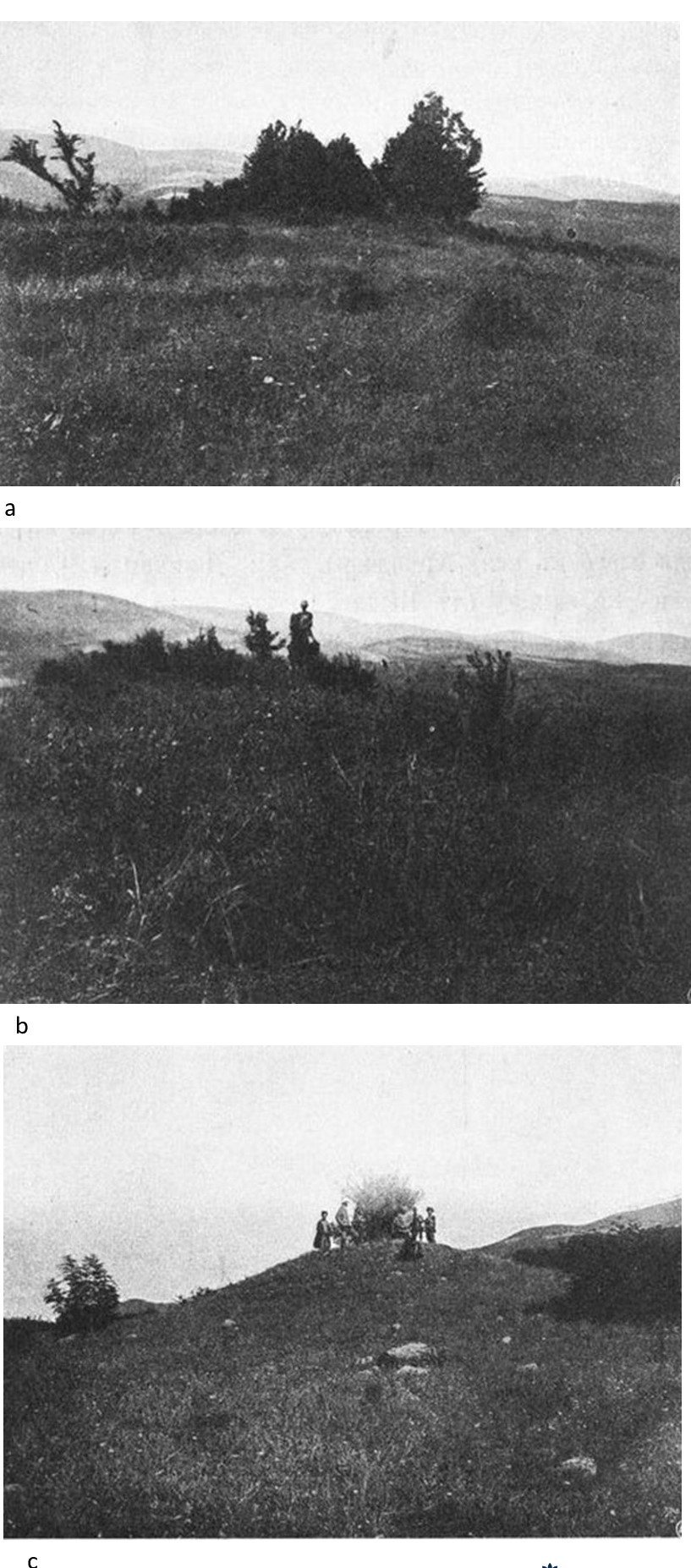
Fig. 1. The burial mounds near the village of Tbghlu (a, b, c), after Ivanovsky 1911, figs. 76, 77, 78.
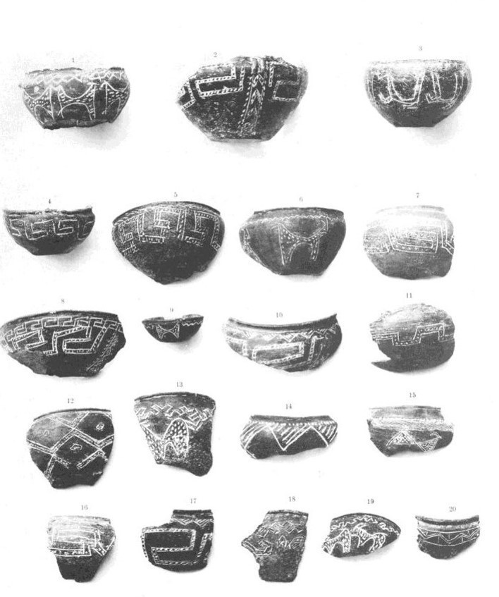
Fig. 2. A small black-clay cup (burial mound no. 78), after Ivanovsky 1911, pl. XIV, 19.
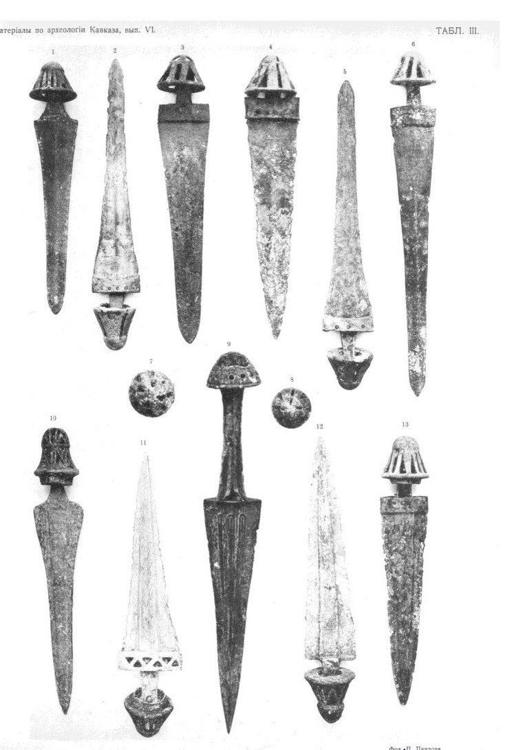
Fig. 3. A bronze dagger (burial mound no. 78), after Ivanovsky 1911, pl. III, 9.
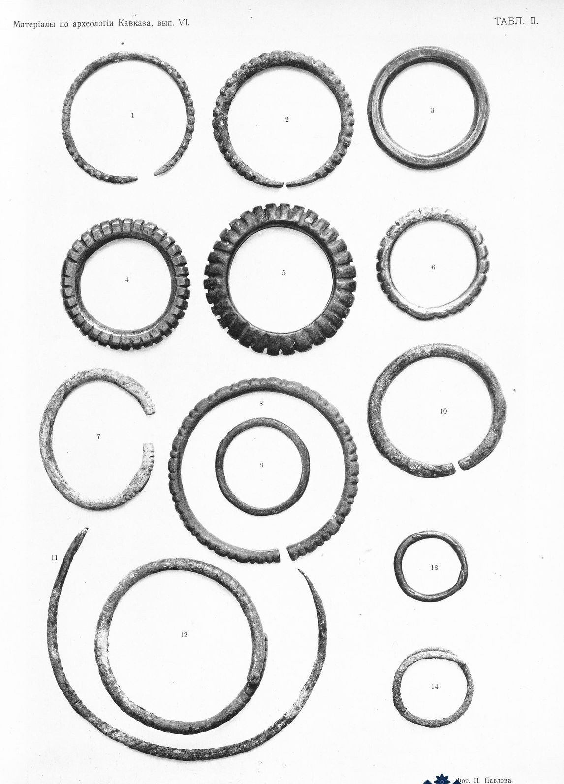
Fig. 4. A bronze bracelet (burial mound no. 78), after Ivanovsky 1911, pl. II, 5.
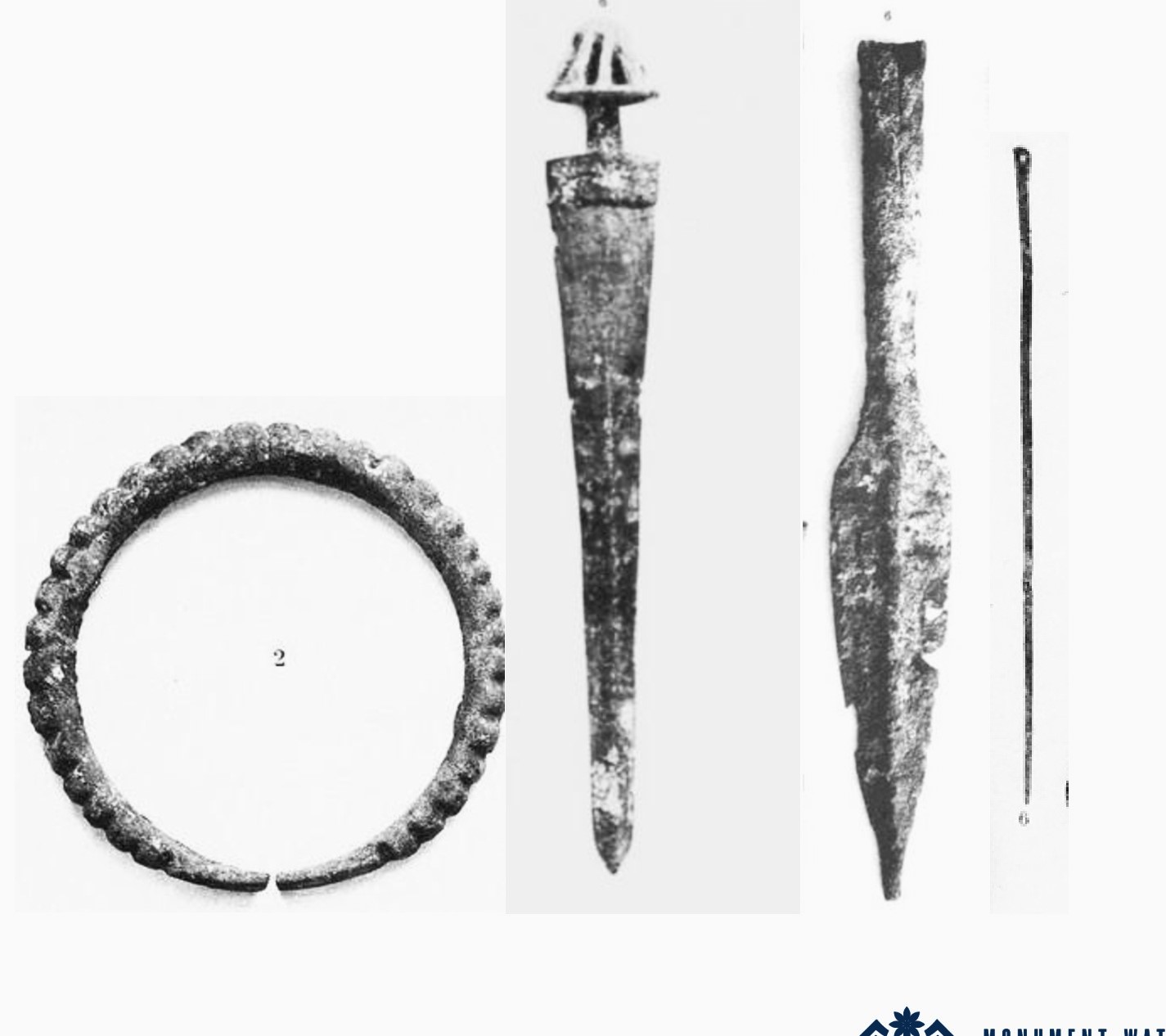
Fig. 5. A bronze bracelet, a bronze dagger, an iron spearhead, and a bronze pin (burial mound no. 79), after Ivanovsky 1911, pl. II, 2; III, 6; V, 6; IX, 9.
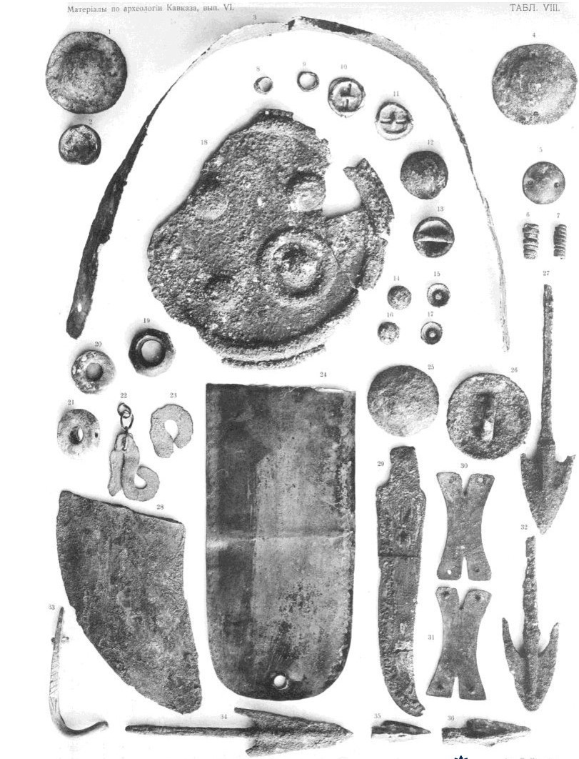
Fig. 6. Bronze buttons (burial mound no. 81), after Ivanovsky 1911, pl. II, 2; VIII, 12–13, 14–17.
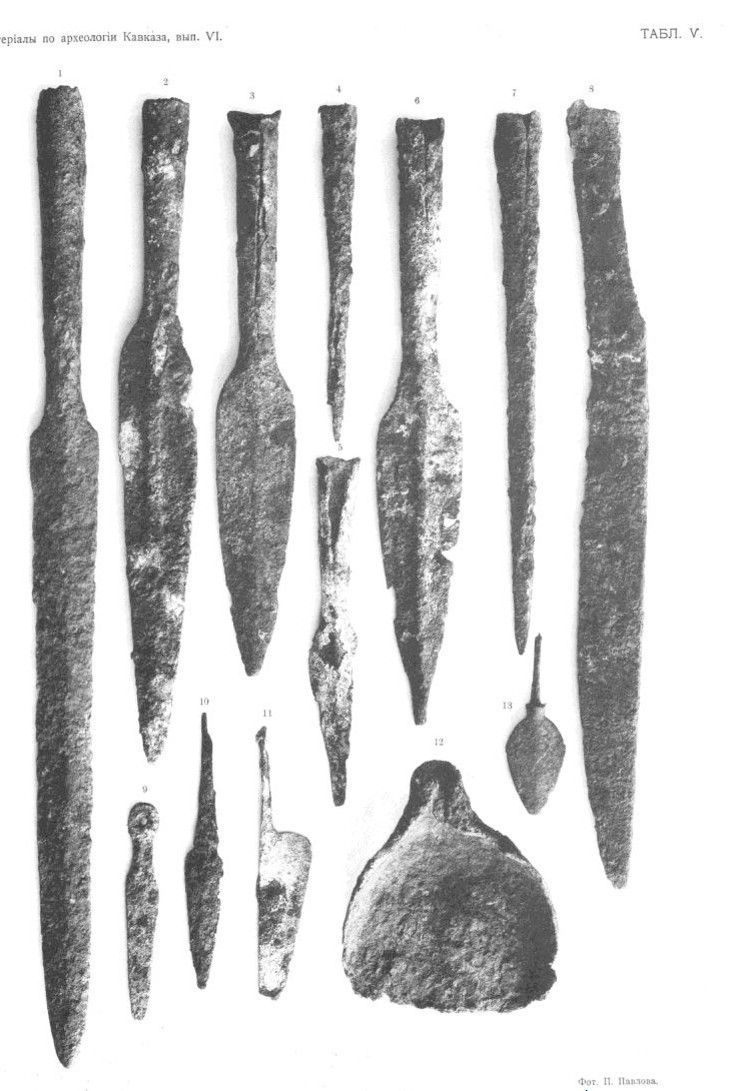
Fig. 7. Iron dart and spearheads (burial mound no. 81), after Ivanovsky 1911, pl. V, 6, 7.
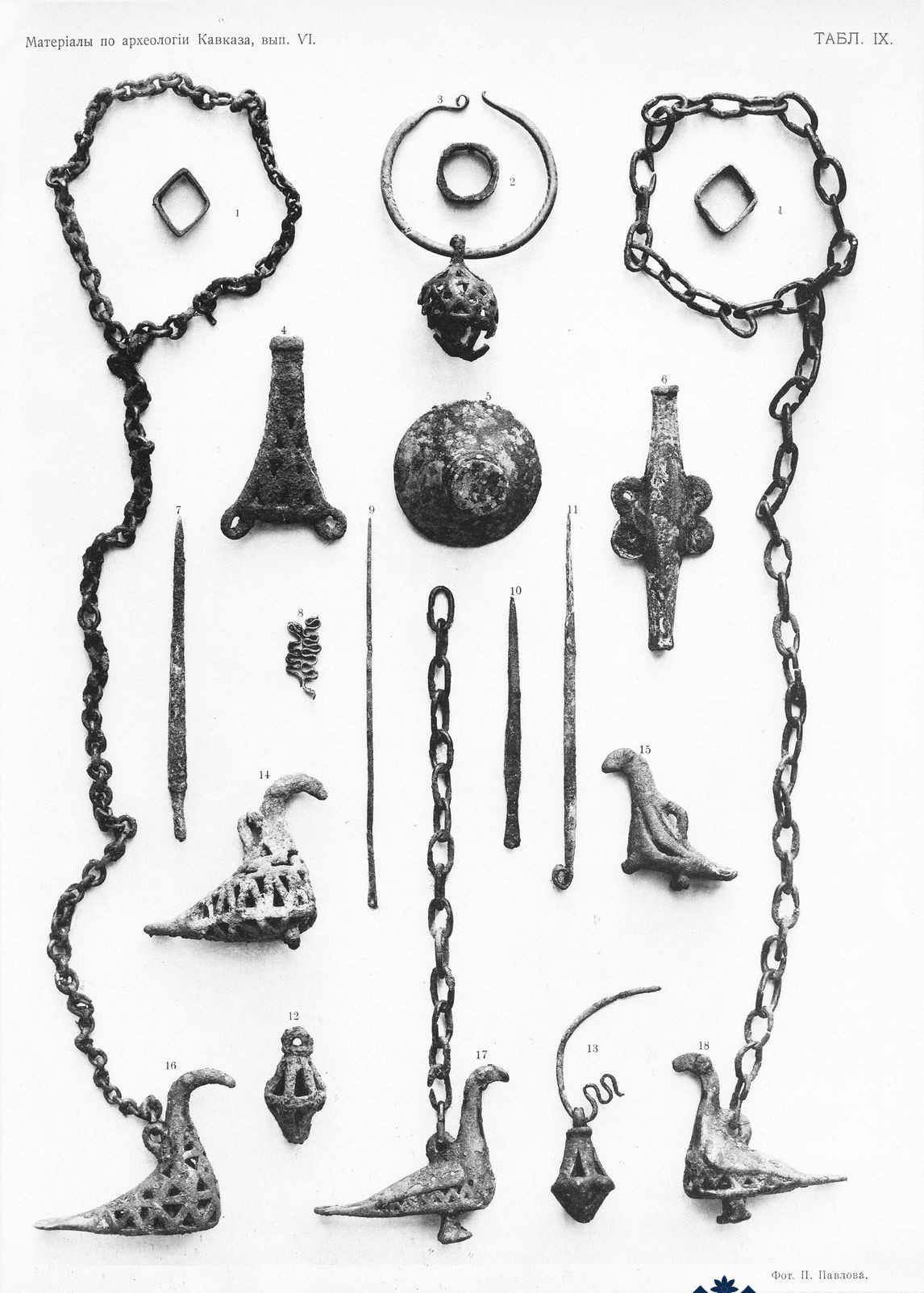
Fig. 8. A quadrangular awl (burial mound no. 81), after Ivanovsky 1911, pl. IX, 11.
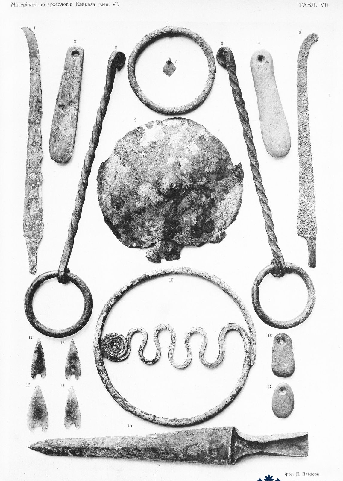
Fig. 9. A bronze dagger, a bronze bracelet, perforated stone pendants, and small obsidian arrowheads, burial mound no. 82, after Ivanovsky 1911, pl. VII, 11–14, 16–17.
The Late Bronze Age Burial Mounds of the Khachenaget Valley
Խաչենագետի հովտի ուշ բրոնզե դարի դամբարանները
Խաչենագետի հովտի ուշ բրոնզե դարի դամբարանները
Արցախ
Խաչենագետի հովտի ուշ բրոնզե դարի դամբարանները
Արցախ