The fortress of Kachaghakaberd
Location
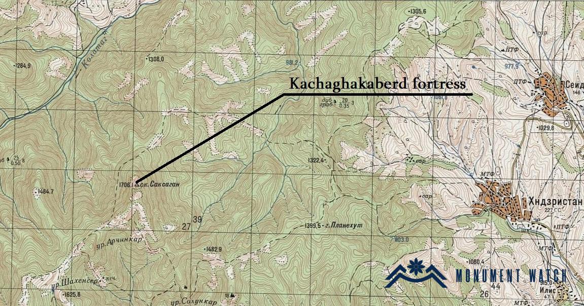
The fortress lies nestled between the villages of Ptretsik and Kolatak. Perched atop the rocky pinnacle of a mountain, the fortress-bearing rock is discernible from the Stepanakert-Gandzasar road. It is positioned at an altitude of 1500 meters (Fig. 1).
Historical overview
The fortress remains largely unexplored, with little information available regarding its foundation and construction. Furthermore, there exists a divergence of opinions regarding its name. B. Ulubabyan posited that Kachaghakaberd is synonymous with the Havkaparats fortress referenced by historians (Ulubabyan, 1975, pp. 136-137). Presently, the appellation "Kachaghakaberd" is linked to a folk legend. M. Barkhudaryants solely mentions the fortress by this name, without providing alternative designations (Barkhudaryants, 1895; 1999). On the other hand, S. Sargsyan, in a separate discourse about Kachaghakaberd, contends that it corresponds to the Khachen fortress mentioned in historical accounts from the 9th century (Sargsyan, 1990, pp. 41-44). However, we find the perspective of A. Hakobyan is more compelling, as he identifies Kachaghakaberd with the appellations Havkapahrats and the folk Saghsaghan mentioned in various sources (Hakobyan, 2020, pp. 301-302).
Architectural-compositional examination
The fortress is situated atop the rocky summit of the mountain (Fig. 2). Encircled by towering, vertical cliffs reaching up to 150 meters in height, access to the fortress is feasible solely from the southwest direction. However, reaching the fortress entails considerable exertion, particularly in the final stretch, as it necessitates scaling the rocky terrain. The entrance to the fortress has not survived. To compensate for the relatively lower and less steep rocks on the southern side, supplementary fortifications were erected in that area.
Only a handful of structures have endured from the fortress, primarily consisting of remnants of the wall, sporadically preserved and constructed from semi-finished, unrefined medium and small stones bound with lime mortar. A segment stretching from the southeastern side to the northeastern side of the fortress is enclosed by a tower wall extending up to 40 meters in length (Figs. 3-5). The pebble stone mortar arrangement of the walls and the forward position of the round tower suggest a construction date in the 12th-13th centuries. Within the fort's precincts, traces of dwellings are observable, some of which are subterranean. The rock foundation upon which the fortress stands measures 150-160 meters in length and 75 meters in width. Presently, the walls stand preserved up to 1.70 meters in height, with a thickness exceeding one meter (Sargsyan, 1990, pp. 46-47; Mkrtchyan, 1985, 25).
In the central area of the fortress, two rock-hewn reservoirs, which collect rainwater, have been remarkably preserved.
The condition before and after the war
The territory of the fortress remained unscathed during the Artsakh wars. However, there is currently no available information regarding the current condition of the monument.
Bibliography
- Barkhutareants 1895 - M. Barkhutareants, Artsakh, Baku.
- Hakobyan 2020 - Hakobyan A., Dynasties in Caucasian Albania and Eastern Armenia from ancient times to the thirteenth century, Yerevan, RA Academy of Sciences Press.
- Mkrtchyan 1985 - Mkrtchyan Sh., Historical and Architectural Monuments of Nagorno-Karabakh, Yerevan.
- Sargsyan 1990 - Sargsyan S., Kachaghakaberd, Yerevan, Journal of Social Sciences, 1990, No. 1, pp. 41-48.
- Ulubabyan 1975 - Ulubabyan B., Khachen's rule in X-XVI centuries, Yerevan.
The fortress of Kachaghakaberd
Artsakh


