The inscription-bearing rock fragment of Akner village
Location
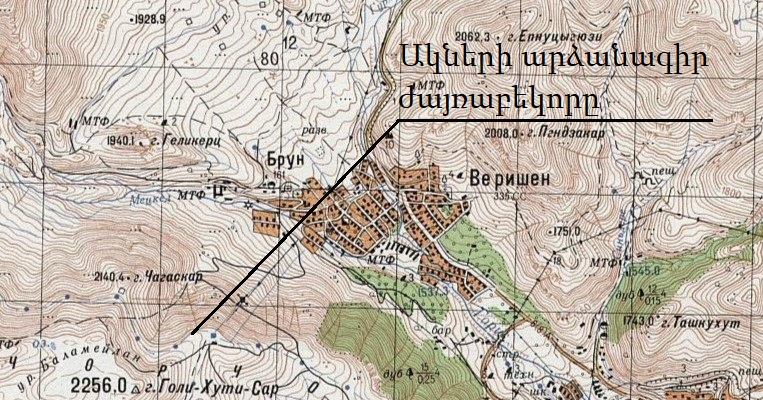
The Akner (also known as Brun) village is situated in the Syunik region of the Republic of Armenia, approximately 84 kilometers from the regional center of Kapan and 4 kilometers from the central community of Goris. The village lies at an elevation of 1,700 meters above sea level. The village of Mokhrenes is home to numerous significant monuments, including the water supply canal of Tatev, which dates back to the 10th century, and an inscription-bearing rock fragment from 1294, known as the "Chghats kar` Cut Stone" (Fig. 1).
J38-21-B-Left-Goris – Copy
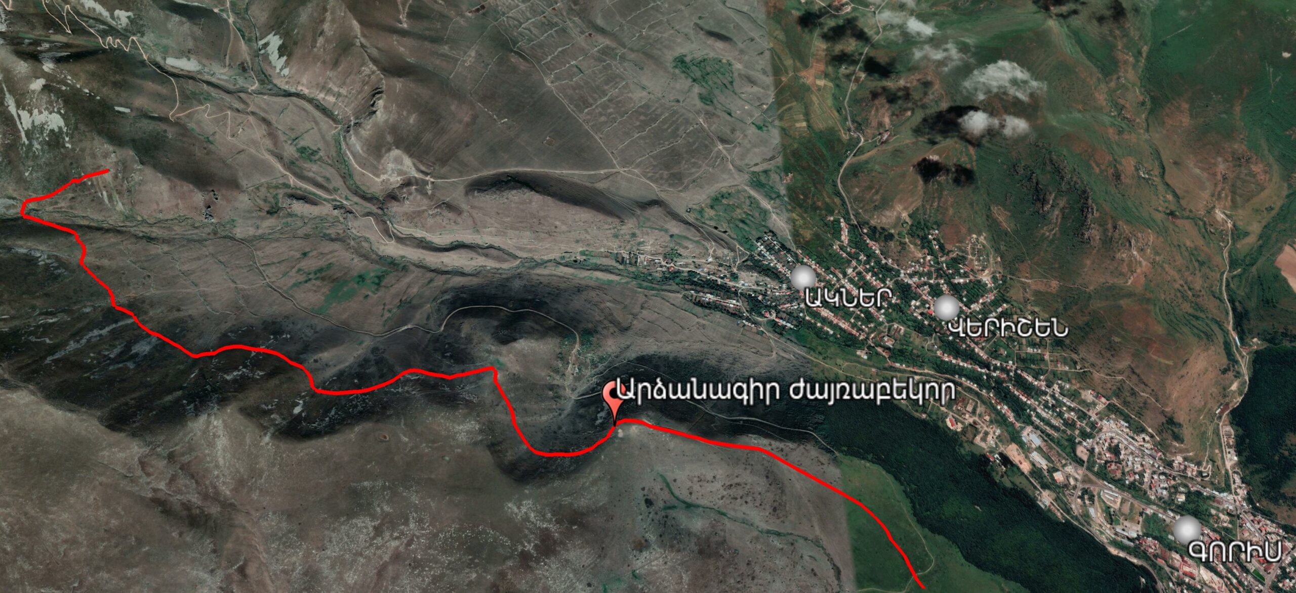
Fig. 1 The 10th-century water supply stream and the inscription-bearing rock fragment, satellite photo by the Monument Watch team.
Historical overview
Several monuments from Akner village are currently listed among the immovable monuments of the history and culture of Verishen village. Although some researchers incorrectly attribute these monuments to the neighboring Verishen community, they are located within Akner village and are integral to its cultural heritage and identity. This misclassification originates from the Soviet era, when, between 1958 and 1990, Akner was administratively part of the state economy of Verishen (as noted on the Goris community website of the Syunik region, RA). Among these monuments is the rock fragment inscribed with "Chghats kar" (Fig. 2).
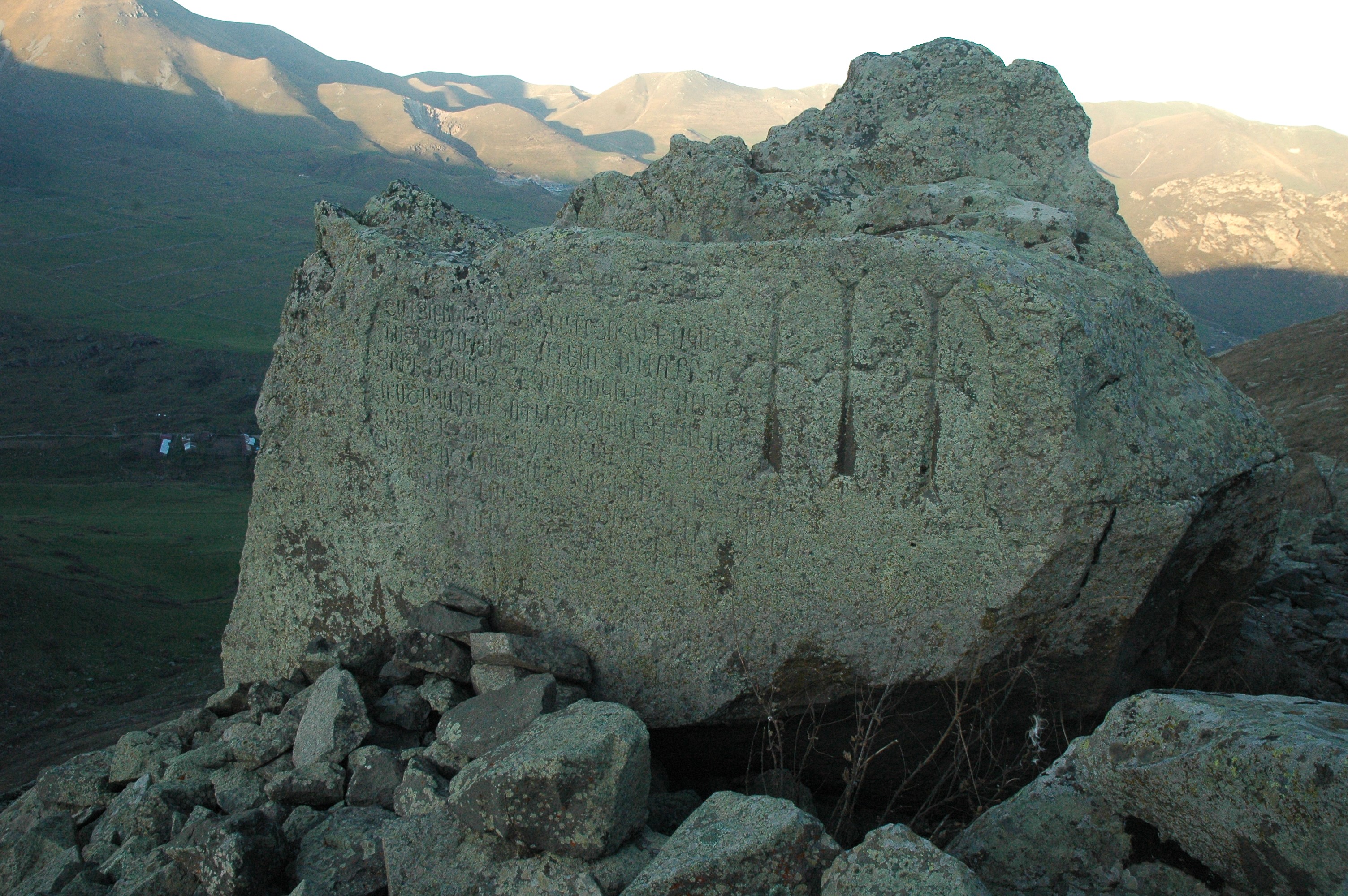
Fig. 2 The inscription-bearing rock fragment of the "Chghats Kar," photo by the Monument Watch team
In 932, Bishop Hakob of Syunik purchased water from the Vararak springs of Dzagedzor from Prince Filipe, the ruler of Syunik, for 12,000 drams and a precious diamond (javahir). He then constructed a 29 km long canal (Fig. 3) to deliver the water to the region known as Tsakut (Orbelian 1910, 253-256). This canal supplied water to the previously uncultivated lands belonging to Tatev Monastery, a vast plain situated above what are now the villages of Halidzor, Shikahogh, and Khot. As a result, the area became known as “Vardut” (meaning rose garden) (Grigorian 1973, 112).
In 1294, Ter Hovhannes undertook the repair of the canal, as detailed in the inscription on the "Chkhats-kara". The inscription states: "In the summer of 743 (1294), I, Ter Hovhannes, by the will of God and the prayers of my spiritual father, Ter Hayrapet, transferred the waters of Vararak to Vardut, which the pious spiritual father Hakob bought with his own money and for which he labored greatly. We repaired the canal, which had long been in ruins, in memory of us and our ancestors. When you see it, remember us in your prayers to Christ with the help of the Holy Trinity" (CAE 2, 78).
Regarding the canal and inscription, Lalayan documented a folk legend in which a priest constructed the canal, referred to as "Keshish-arch" by the locals. According to the story, when the water reached a large rock, the priest exclaimed about the immense size of the rock, and the rock miraculously split in two. Witnessing this, a nearby farmer remarked on the priest's "good eye," and as a result, the priest’s eye was struck blind (Lalayan 1898, 130).
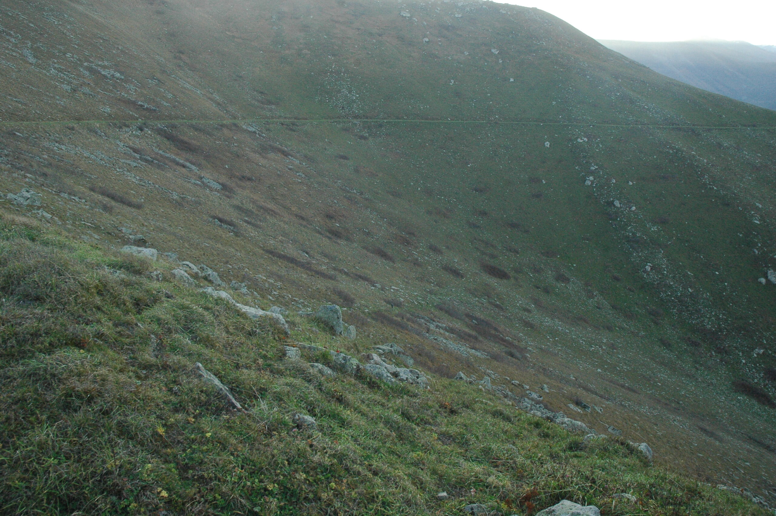
Fig. 3 A preserved part of the canal, photo by the Monument Watch team.
Architectural-compositional examination
The waters from the springs located to the north of Akner village were channeled to an area of approximately 100 hectares near Tatev through a 29 km long earthen canal (Fig. 4). In 1294, Archbishop Hovhannes of Tatev repaired the canal and left a construction inscription on a large fragment of a cracked rock in the vicinity of Akner village.
Three crosses are depicted on the right side of the eight-line inscription. S. Barkhudaryan notes that the "Arabic-like" script preserved in the upper part of the Armenian inscription (Fig. 5) is identified as Middle Persian from the 7th century, according to "Leningrad experts" (CAE 2, 75).
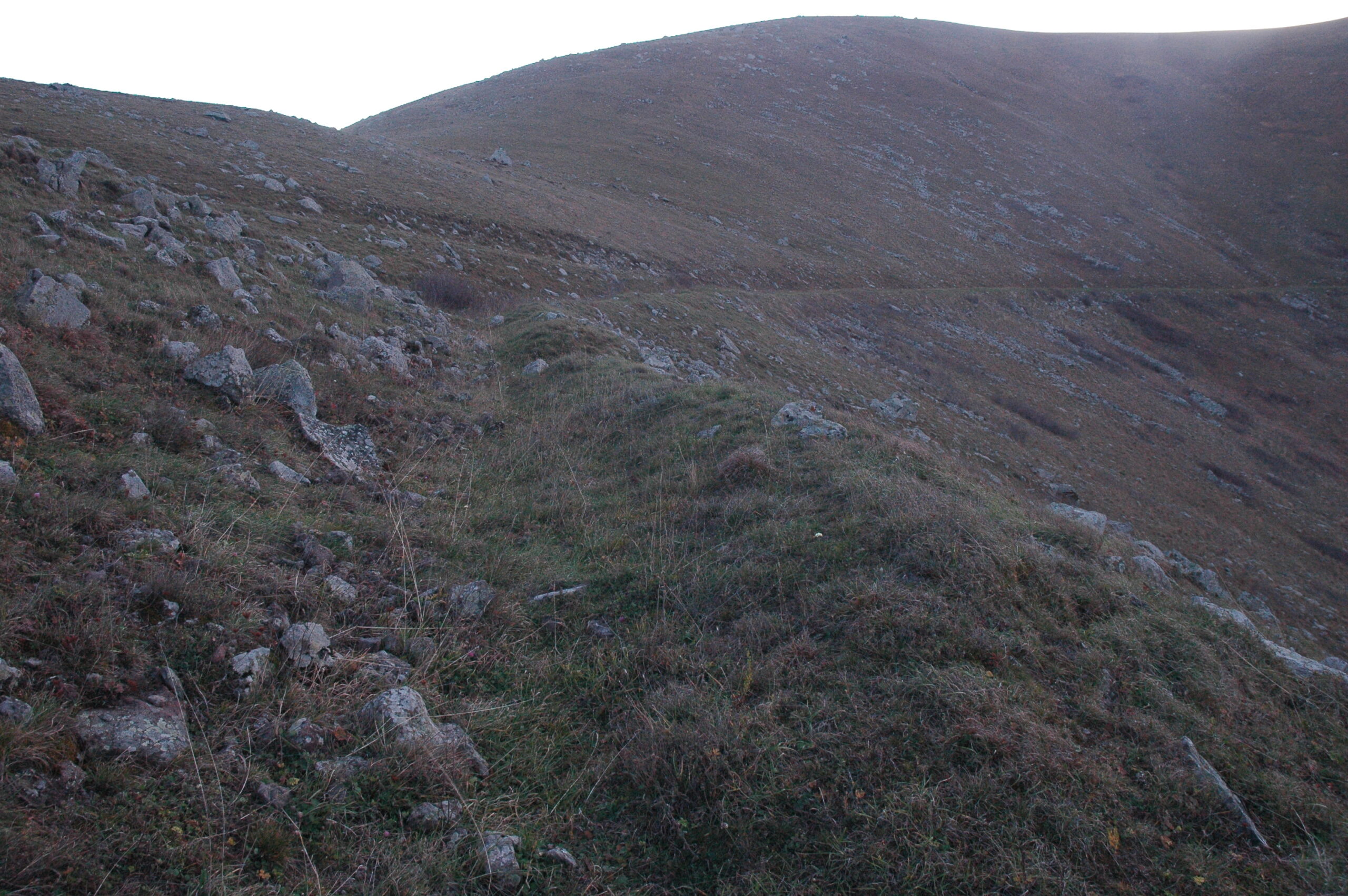
Fig. 4 A preserved part of the canal, photo by the Monument Watch team.
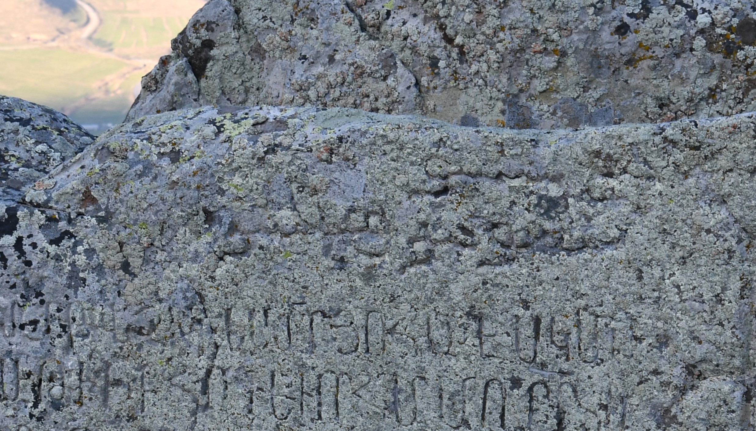
Fig. 5 The surviving Middle Persian script at the top of the inscription, photo by the Monument Watch team.
By the end of the 19th century, the canal had ceased to function, and Vardut reverted to being called Tsakut (Lalayan 1898, 130). In the early years of Soviet rule, a hydroelectric station and its associated waterfall structures were constructed near the canal and the inscription-bearing rock fragment (CAE 2, 75). In 1966, G. Grigoryan published an article in Soviet Armenia daily titled "Land, Water, and People," in which he proposed restoring the historical canal to revitalize Tsakut (Grigoryan 1966, 1).
The condition following the Azerbaijani aggression in 2020-2022
After the 44-day Artsakh war and the resulting border changes, the "Chghats Kar" rock fragment in Akner is now located 5.9 kilometers from the border.
Bibliographic examination
- Lalayan read the date as 741 instead of 743 in the inscription on the "Cghats-kar" rock fragment. S. Barkhudaryan notes that the scribe later corrected the date in the inscription (CAE 2, 75).
Bibliography
- Grigoryan 1966 - Grigoryan G., Land, water and people, Soviet Armenia, N 142, Yerevan.
- Grigoryan 1973 - Grigoryan G., The monastic estates of Syunik in the IX-XIII centuries, Yerevan.
- CAE 2 - Corpus of Armenian Epigraphy, issue 2, Goris, Sisian and Ghapan regions, compiled by S. Barkhudaryan, Publishing House of Academy of Sciences of Armenian Soviet Socialist Republic , Yerevan, 1960.
- Lalayan 1898 - E. Lalayan, Ethnographic Journal, Book 3, Tiflis.
- Orbelian 1910 - Stepanos Orbelian, History of the Province of Syunik, Tiflis.
- Akner rural settlement, website of Goris community of Syunik marz, RA, https://www.goriscity.am/Pages/CustomPage/?CustomPageID=722b890c-cc0b-4c5d-bdf2-30fbebab4291, 08․01․2024