The Surb Stepanos Monastery of Vachar encompasses the Surb Stepanos single-nave church, the two-story Surb Stepanos chapel-reliquary situated adjacent to it from the south, the westward gavit connected to the chapel, and the surrounding tombs (Figs. 1-3). Additionally, remnants of a stone-cut gate adjacent to the church’s north side and the khachkar wall, confirmed through excavations, have been preserved. The entire complex is embraced by ramparts fortified with towers. Within the walls, both to the south and north of the primary complex, vestiges of other stone-built structures are evident. Beyond the walls, the traces of extensive cemeteries extend from south to north.

Location The monastery is located in the Martakert region of the Republic of Artsakh, approximately 8 kilometers northeast of Haterk village, on the high part of a wooded mountain range that runs along the right bank of the Trghi River (Karapetyan 1986, 86). Historical overview There is no precise information available about the church. The information on several inscriptions on the monastery’s walls and grounds is incomplete due to their partial preservation. The etymology of the monastery’s name is also unknown. Makar Barkhudaryants refers to it as Masis or Msis, which is a popular folk name (Barkhudaryants 1895, 202). Haterk residents refer to it as Mesis. Architectural-compositional examination The monument group comprises a church, gavit, two-story chapel, and walls, next to which the ruins of rooms have been preserved (Fig. 1). Early khachkars and cross-sculptured slabs used as construction stones are visible along the complex’s walls. It was a phenomenon that was particularly popular in the 13th century. The church is a single-nave vaulted structure with two entrances: one from the west, which leads into the gavit, and one from the north, which leads into the chapel (Fig. 2). The church’s tabernacle has a subtle curvature in the section and no sacristies (Fig. 3). The only window is on the east facade of the building (Fig. 4). The church is entirely made of rough and unpolished stones, as well as lime mortar (Fig. 5). The complex was most likely constructed between the 12th and 13th centuries. It was internally plastered, and the traces can be seen near the high altar. The western entrance porch was built with several stones that were engraved with the four-line construction inscription. Unfortunately, the only thing that can be deduced from the preserved sections is that it refers to the church’s construction (Karapetyan 1986, 87).
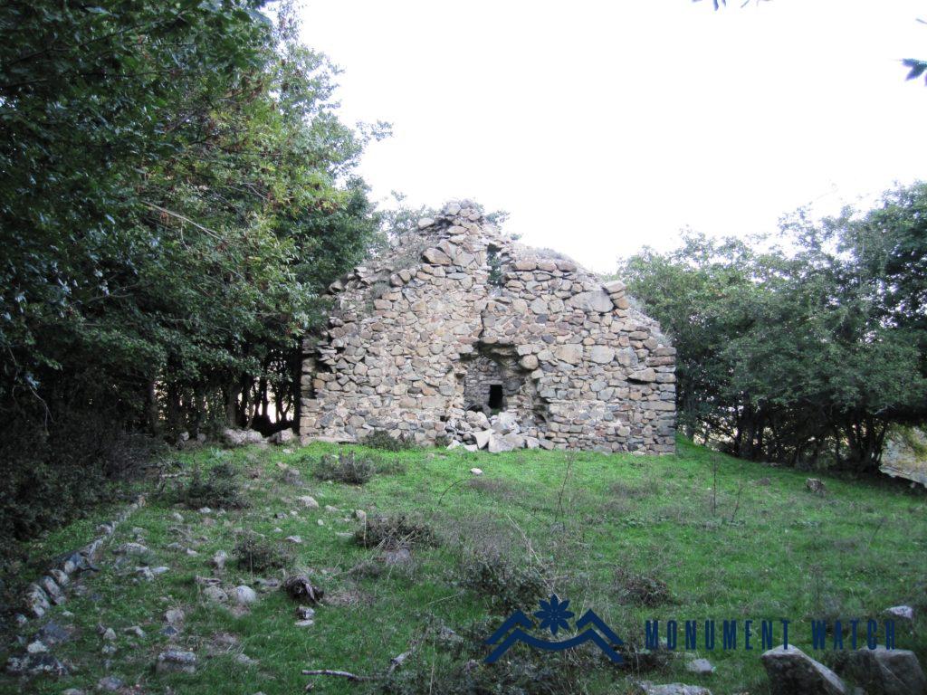
Location The Anapat monastery is situated on a hill between two ravines one kilometer west of Taghaser village in the Hadrut region (Fig. 1). Taghaser has been under Azerbaijani occupation since October 2020. Historical overview The monastery’s construction history has not been preserved. The name implies that there was a monastery-anapat here. Both the monastery and the hill are referred to as Napat by locals. Architectural-compositional examination The monastery was comprised of the church and several buildings to the west and south of it, from which only the traces of the walls have been preserved (Fig. 2, 3). In some places, the foundations of the wall that surrounded the monastery have been preserved. The church is a vaulted single-nave hall. It has a semi-circular tabernacle with two narrow sacristies on the eastern side (Fig. 4). The construction dates are most likely the 13th and 14th centuries. The entrance is on the west side (Fig. 5), and it is illuminated by windows on the east, south, and west sides. The sundial on the south wall has been preserved (Fig. 6). It’s made of raw limestone and lime mortar from the area. The wall structure was built with Khachkars (Fig. 7). Multiple khachkars have been preserved inside the church, one of which bears an inscription (Figs. 8, 9, 10, 11). It measures 12.9 meters long, 6.1 meters wide, and 5.5 meters tall.
