The Jarvanes Bridge

Location

The Jarvanes Bridge is situated approximately 2.5 km northwest of Tumi village in the Hadrut region, spanning the Tumi tributary of Ishkhanaget (Figs. 1, 2).

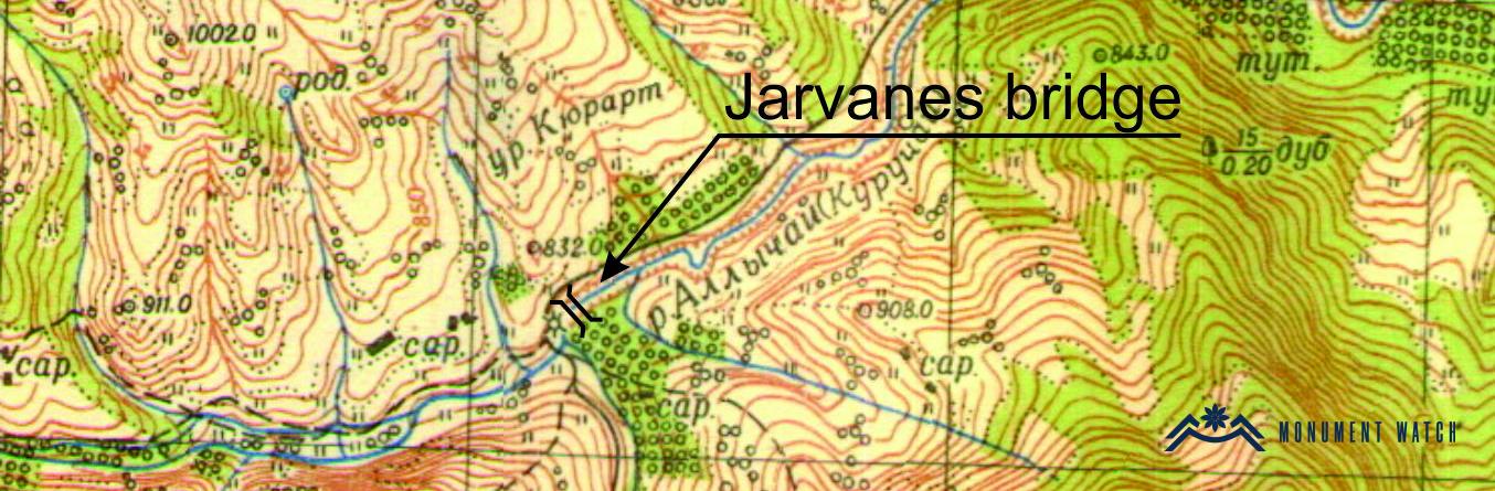
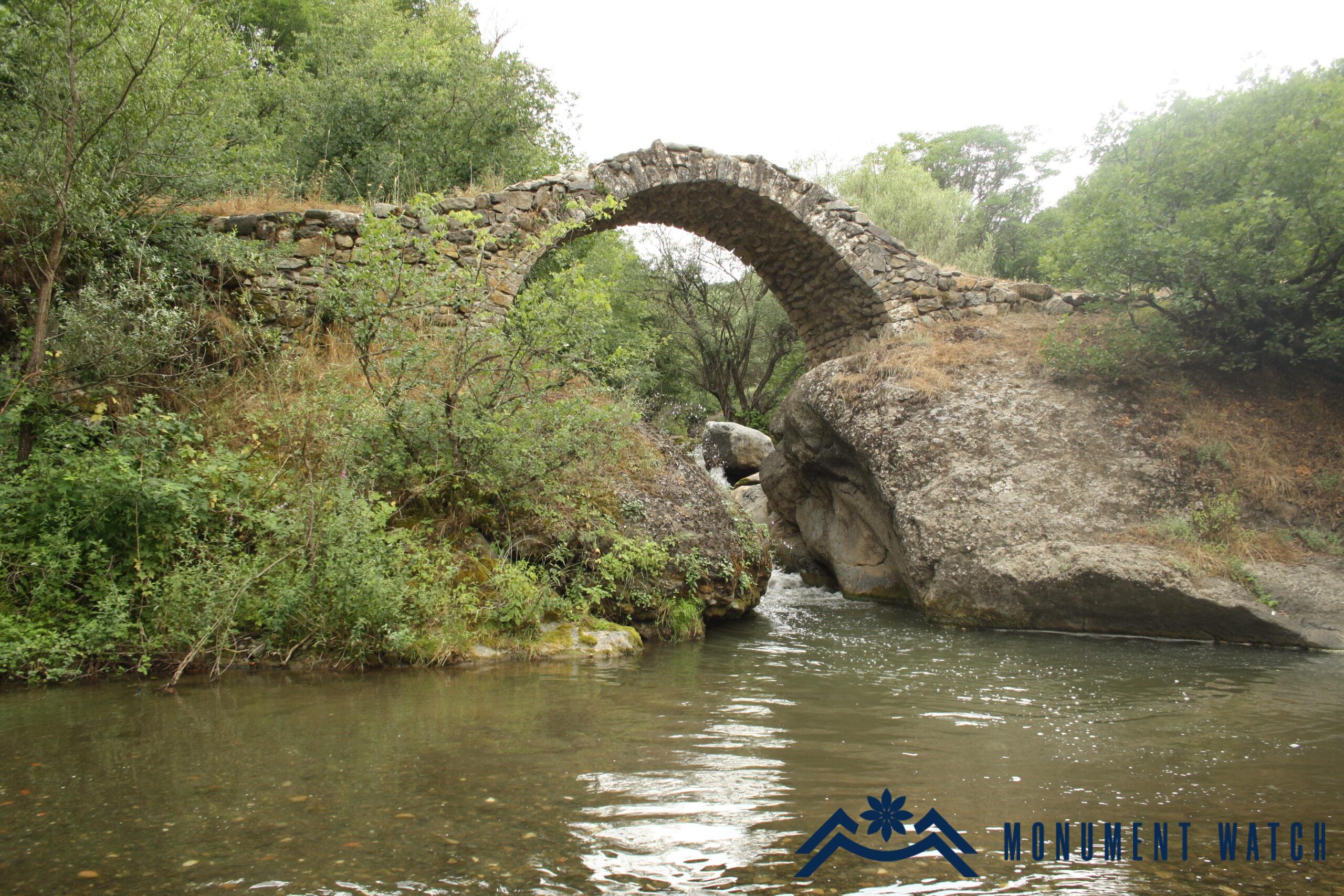
Fig. 1 The general view of the bridge, 2014, photo by S. Danielyan.

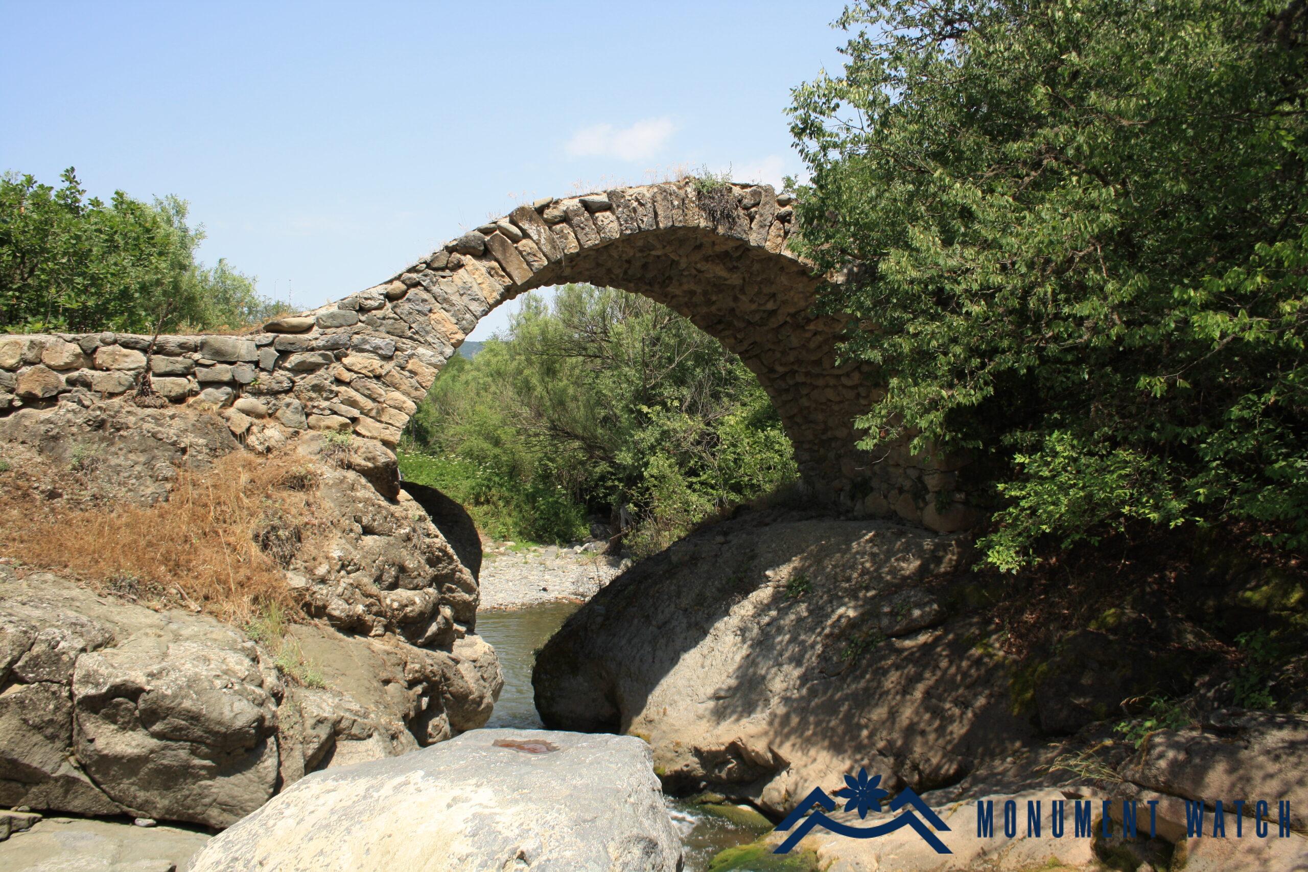
Fig. 2 The view from the west, 2014, photo by S. Danielyan.

Historical overview

The bridge, known as Jarvanes or Jrvanes, lacks historical documentation regarding its construction. However, based on its architectural and construction features, it is believed to have been built in the mid-13th century. The bridge served as a crucial road junction, connecting the Ktish fortress, Gtchavank, and the northern regions.

Architectural-compositional examination

The bridge was designed and constructed for both pedestrians and carriages. It features a single-span vaulted structure. It is constructed using rough, raw, and unpolished stones, reinforced with lime mortar. The bridge piers' foundations are set upon substantial natural rocks (Figs. 3, 4).

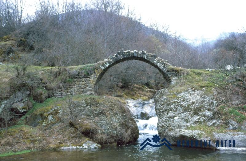
Fig. 3 The upstream facade of the bridge, photo by S. Karapetyan.

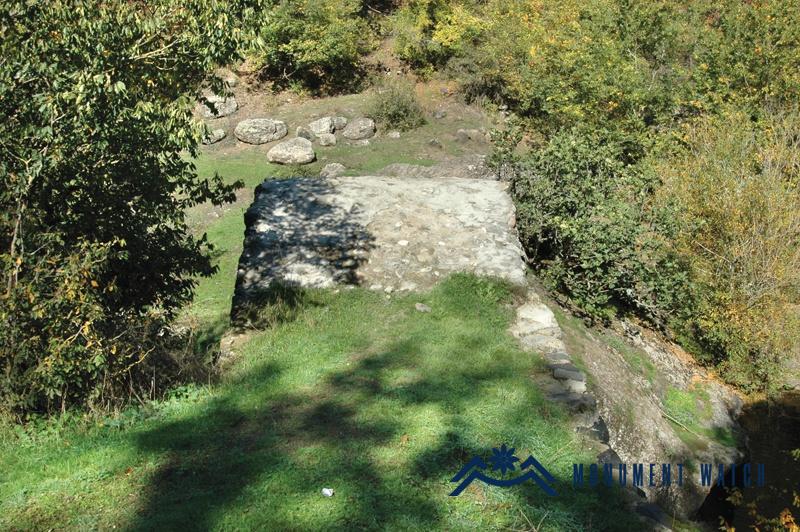
Fig. 4 The Bridge passageway, photo by S. Karapetyan.

The span's length measures 5.30 meters, the passage width is 3.01 meters, and the height above the water level is 6 meters (Fig. 5).

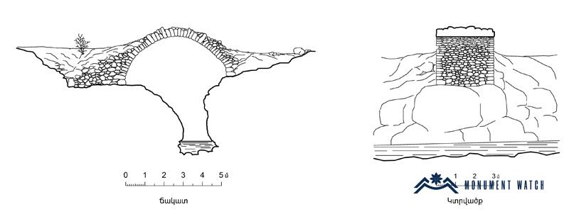
Fig. 5 The Measurement and section of the bridge, 2001, measurements by S. Karapetyan.

The condition before, during, and after the war

The bridge remained in good condition and operational, sustaining no damage during the 44-day war. While current information about the monument's present status is not available, based on Google Earth satellite images as of 2021, the bridge is still standing (Fig. 6).

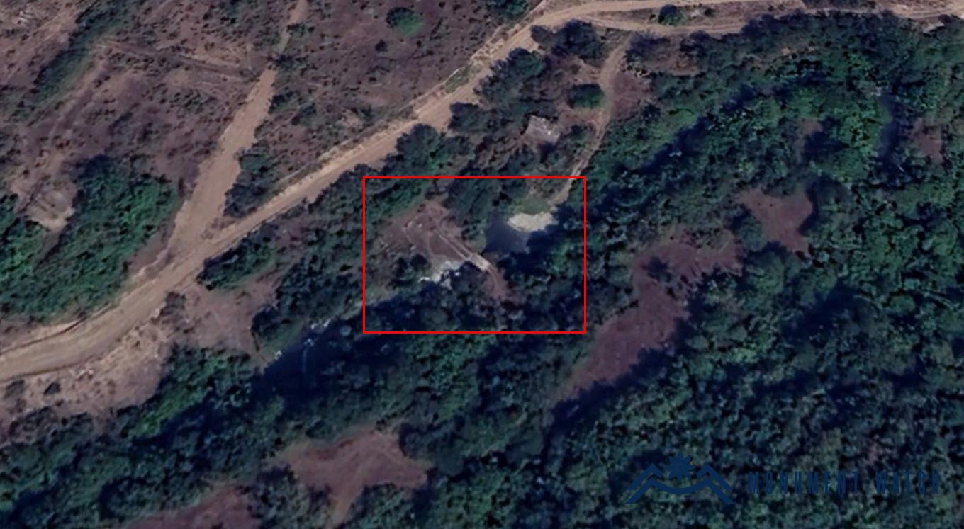
Fig. 6 The Satellite photo by Google Earth service, 23.08.2021.

Bibliography

  1. Karapetyan S., Bridges of Artsakh, Yerevan, 2009.
The Jarvanes Bridge
The Jarvanes Bridge
The Jarvanes Bridge
Artsakh