The Karablur Settlement and Burial Grounds

Location

The Karablur settlement is situated near Lusadzor village in the Askeran region of the Republic of Artsakh. Covering approximately 1.5 hectares, it comprises a three-level platform and encompasses cultural layers dating from the Middle Bronze Age to the Late Middle Ages. Surrounded by formidable burial grounds, it occupies a prominent position within the Karkar and Badara Mesopotamia region. Notably, it stands as the highest point in the vicinity, just one kilometer away from the renowned Khojalu cemetery (Petrosyan 2001, 347). However, it has been under Azerbaijani occupation since September 2023.

Historical overview

Exploratory excavations were conducted at this site during July-August 1996 by a joint expedition comprising members from the Institute of Archaeology and Ethnography of the National Academy of Sciences of the Republic of Armenia and Artsakh State University, co-led by H. Petrosyan and L. Episkoposyan. Subsequent excavations took place from July 2002 onwards, led by the Artsakh State University expedition under the leadership of V. Safaryan.

The 1996 archaeological survey phase

During the 1996 archaeological survey phase, the settlement underwent investigation, leading to the excavation of a medieval sanctuary situated on the third platform of the monument. This structure is characterized by its west-east orientation and features an eastern rectangular apse-stage, with a table monument erected at its center (Fig. 1). Within the prayer hall of the sanctuary chapel, adjacent to the bema, a hearth constructed from four stones was discovered (Fig. 2). Surrounding this hearth were numerous pottery fragments dating back to the 12th-14th centuries, amounting to several hundred pieces (Figs. 3-6).

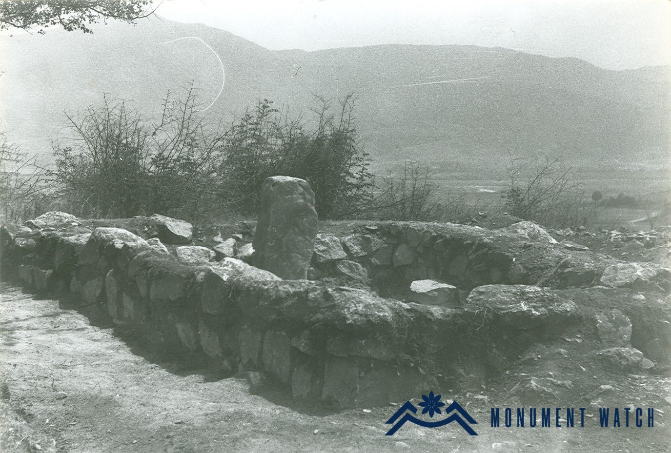
Fig. 1 The medieval sanctuary from the west, photo by H. Petrosyan.

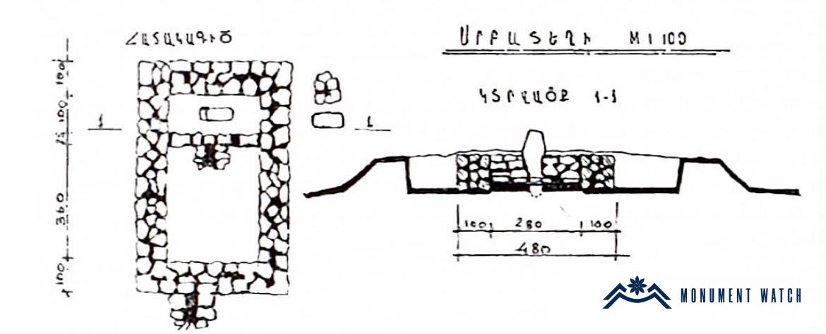
Fig. 2 The drawing of the sanctuary chapel, architect: V. Hovsepyan.

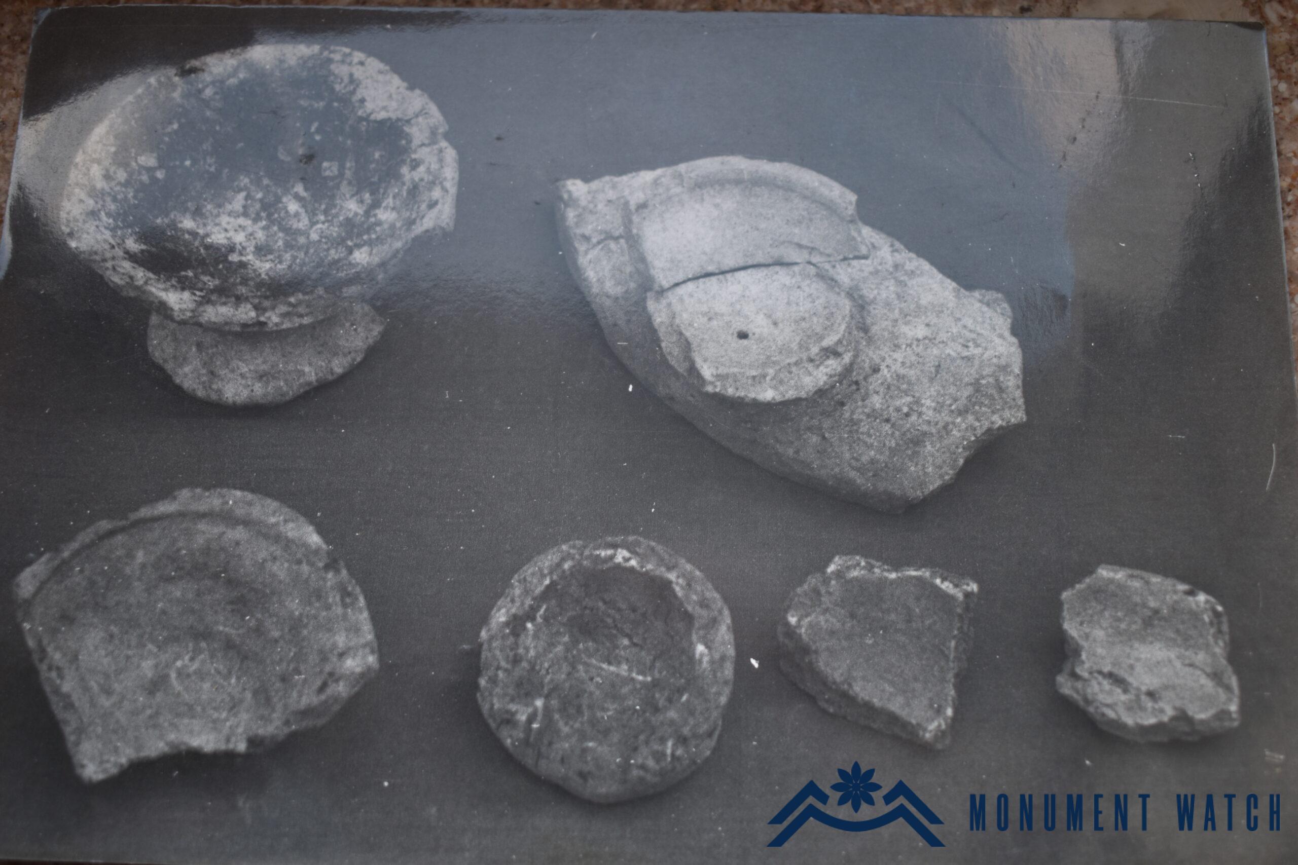
Fig. 3 Fragments of pottery found in the sanctuary chapel, stone mills, sand, photo by H. Petrosyan.

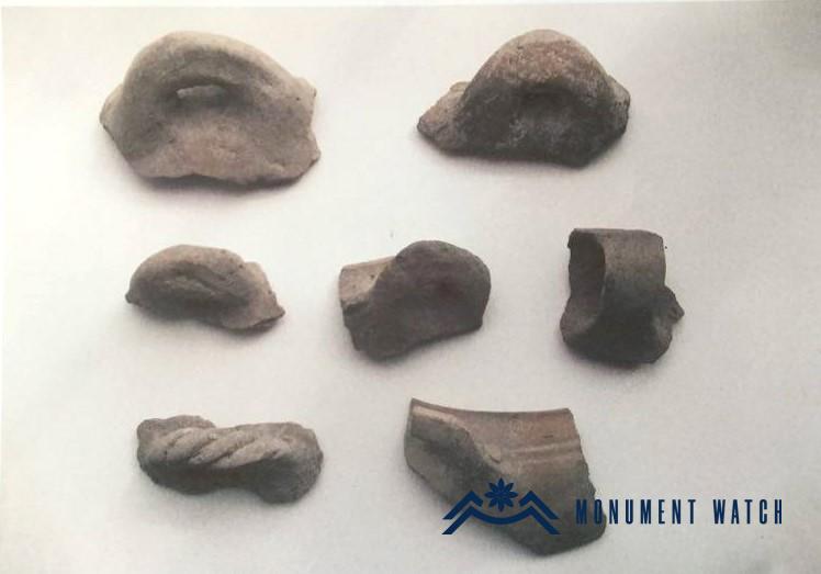
Fig. 4 Fragments of pottery found in the sanctuary chapel, stone mills, sand, photo by H. Petrosyan.

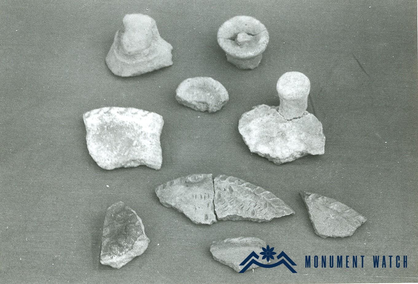
Fig. 5 Fragments of pottery found in the sanctuary chapel, stone mills, sand, photo by H. Petrosyan.

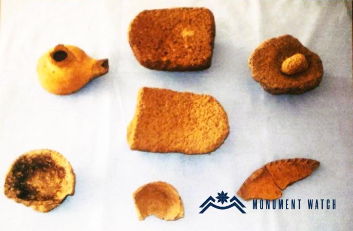
Fig. 6 Stone mills, alumnus found in the sanctuary chapel, photo by V. Safaryan.

Two burial plots were unearthed during the excavation, positioned to the east and west of the settlement. The western tomb field is associated with the 9th to 8th centuries ( Fig. 7), while the eastern one, characterized by numerous large and small mounds, cromlechs, and stone boxes, dates back to the 11th to 9th centuries (Fig. 8).

These burial grounds coincide in time with the burial mounds found at Tolors, Aparadzor, and Khojalu.

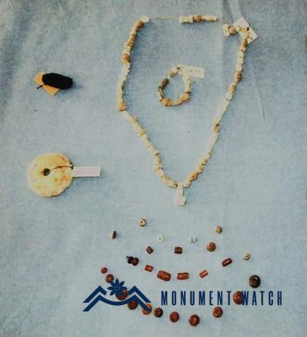
Fig. 7 Examples from the property of the tomb of the western burial plot, photo by V. Safaryan.

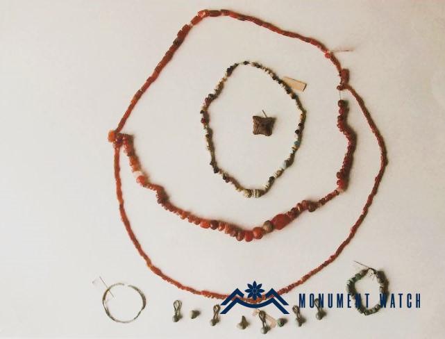
Fig. 8 Examples from the property of the tomb of the eastern burial plot, photo by V. Safaryan.

The 2002 excavations

In 2002, the ASU expedition conducted exploratory excavations in the eastern cemetery of Karablur, aiming to establish its potential connection with the renowned cemetery of Khojalu. During these excavations, a burial mound situated in the southeastern section of the burial ground was carefully excavated and investigated.

The soil covering of the burial mound consisted of loam, overlaid by two rows of stone belts. The first row was positioned at a depth of 0.15 meters, while the second row was located at a depth of 0.45 meters (Fig. 9). Notably, there was no stone zone in the earth cover of the eastern and northeastern parts of the burial mound.

At the heart of the mound lay the burial chamber, constructed in the form of a stone box and oriented from southwest to northeast. Its dimensions were 5.4x1.75x1.9 meters (Fig. 10). This chamber was positioned centrally within the mound and was originally covered with large limestone slabs. However, only one of these covering slabs remained in place, measuring 3.05x1.3x0.3 meters. The burial chamber featured a 1.2-meter-wide corridor-dromos extending from the south (Fig. 11).

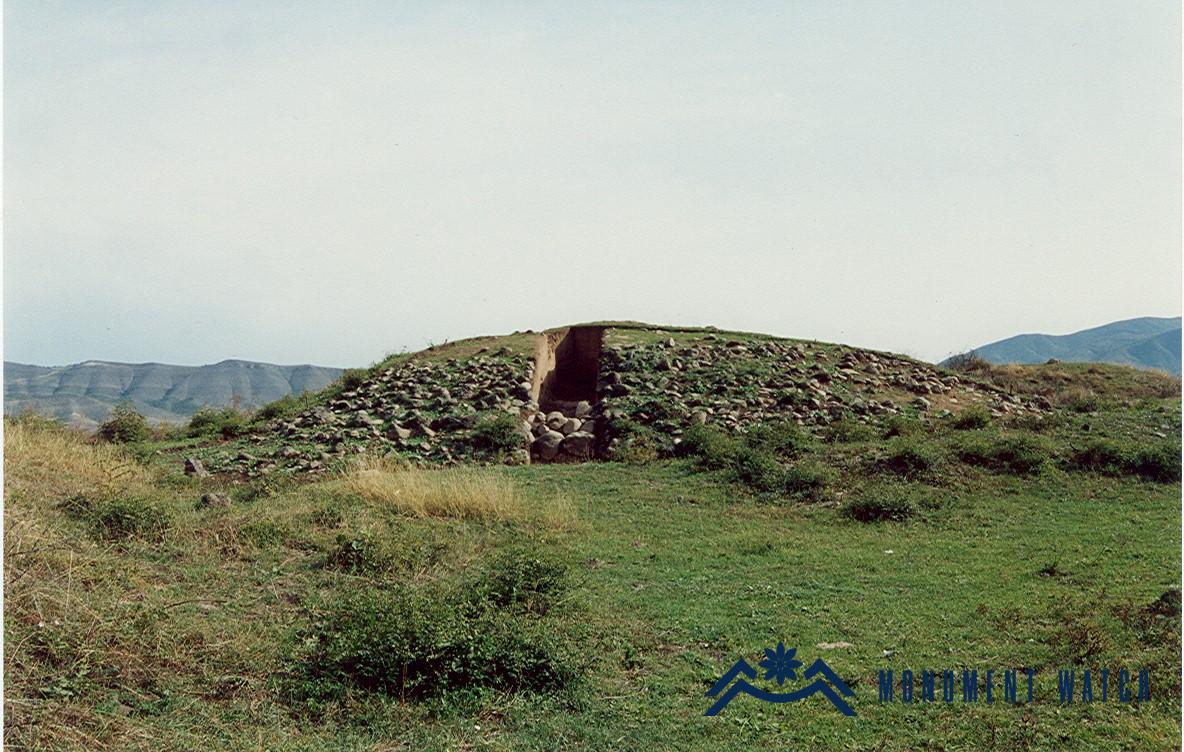
Fig. 9 The general view of the excavated burial hill of the eastern cemetery, photo by H. Petrosyan.

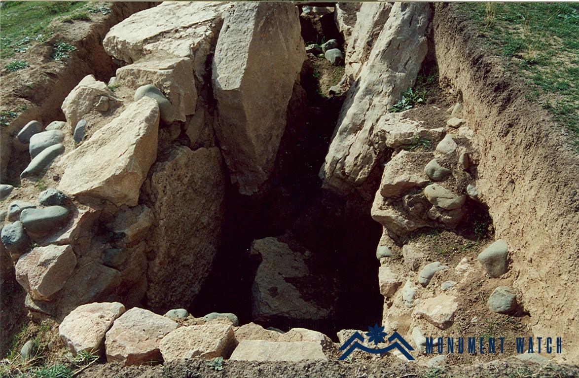
Fig. 10 The burial chamber of the eastern burial hill, photo. H. Petrosyan.

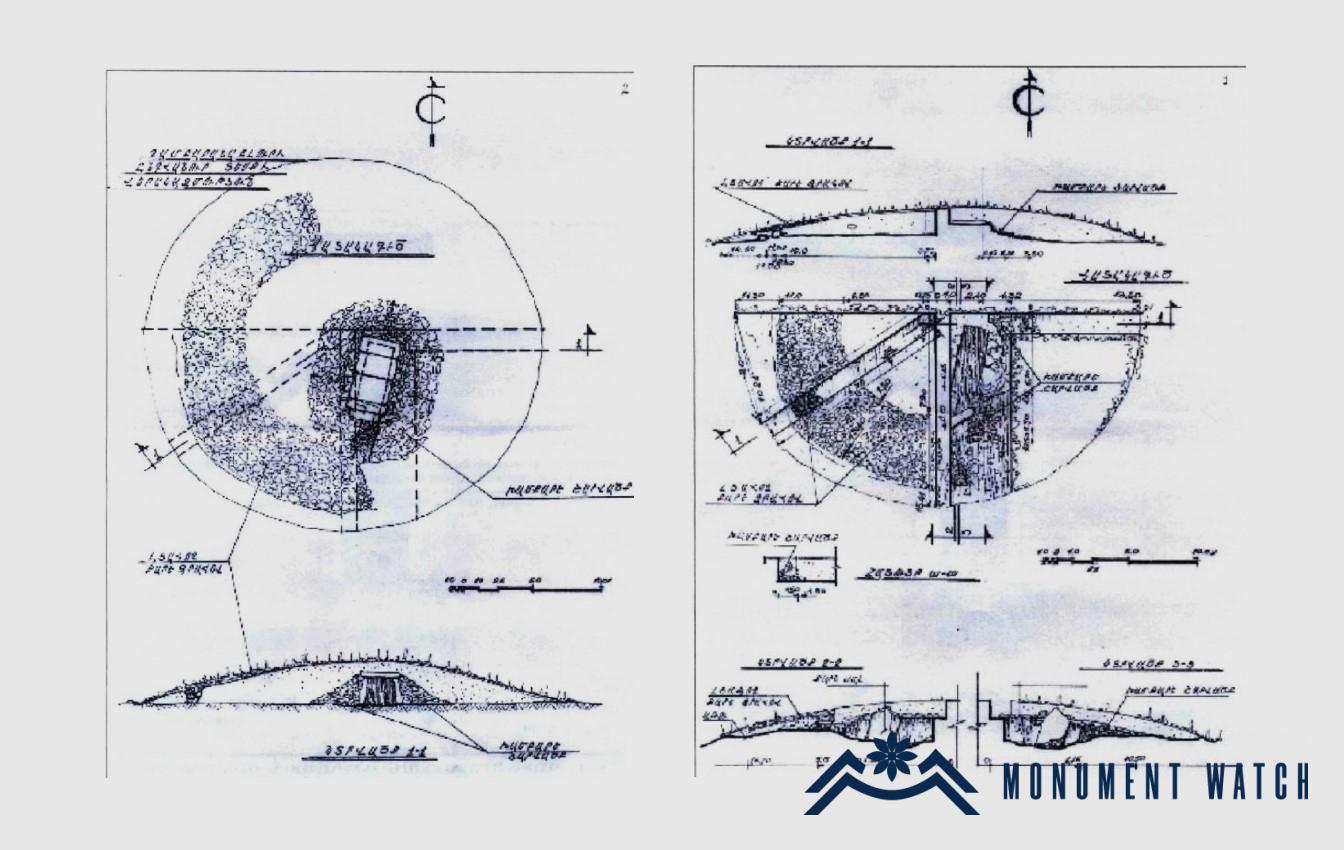
Fig. 11 Reconstruction and longitudinal section of the excavated burial hill of the eastern mausoleum, architect: M. Titanian.

A secondary burial was discovered on the intact covering layer, situated in the eastern section of the site, at a depth ranging from 0.65 to 0.80 meters. Within this layer, two skull remains were documented, which are believed to belong to children. It is conceivable that these child burials could be associated with the practice of human sacrifices (Fig. 12).

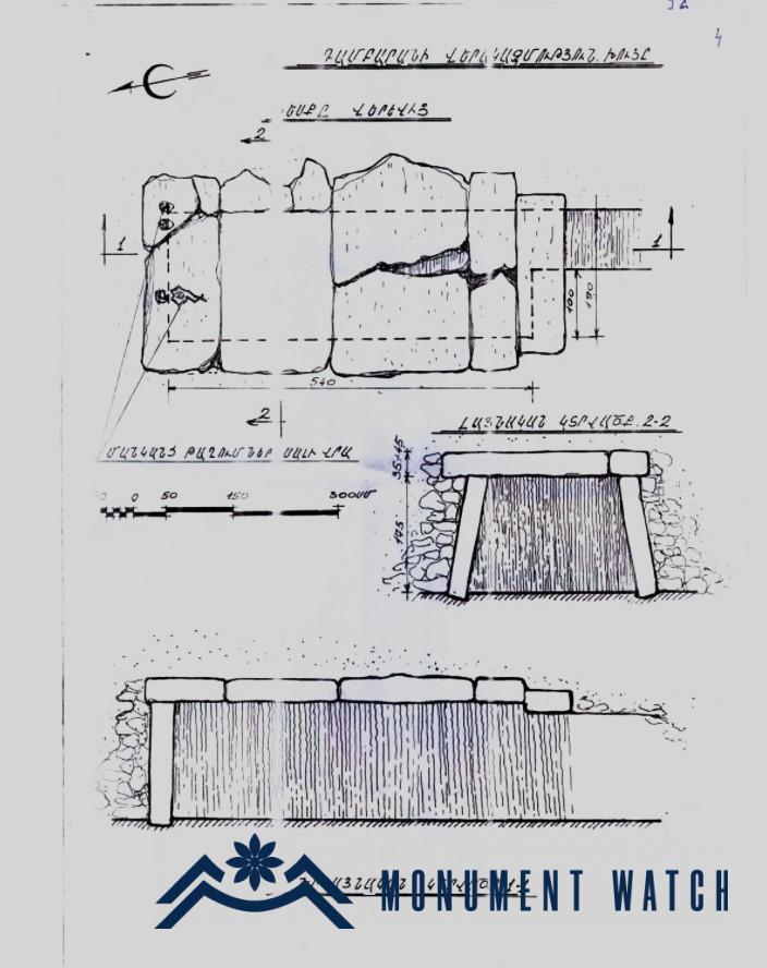
Fig. 12 A Secondary burial, in the eastern part, architect: M. Titanian.

Various animal bones (including those of oxen, dogs, sheep, and birds), pottery fragments, and traces of ash were discovered both within the burial chamber and along the dromos at various depths. Interestingly, similar evidence of fire was also found in the large earthen burial mounds of the Khojalu cemetery (Safaryan, Petrosyan, Balayan 2009).

The contents of the excavated burial mound include a variety of items, such as a bronze bracelet with jointed ends, a bronze ring with non-joined ends, fragments of a bronze belt, a bronze rivet with a diamond-shaped cap, bronze buttons, fragments of iron knives, as well as beads made of cornelian, quartz, vitreous, and pottery fragments (Fig. 13). These discovered artifacts are commonly found in other archaeological sites such as Khojalu, Khrtanot, Golovino, Lori-Berd, Lchashen, and Artik, dating back to approximately the 11th-9th centuries BC.

There are certain similarities between the Khojalu and Karablur burial mounds. They share similar structural features and burial rituals, such as burying animals and accompanying materials with the deceased.

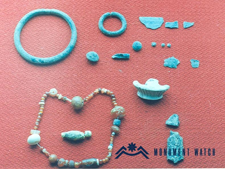
Fig. 13 Examples from the property of the tomb of the eastern burial plot, photo by V. Safaryan.

The condition before, during, and after the war

Before the war, the monument was in a good state of repair.

Bibliography

  1. Petrosyan, Yepiskoposyan and others, 1998 - Petrosyan H., Yepiskoposyan L., Asryan Yu., Safaryan V., Balayan V., Hovsepyan V., Exploratory excavations in the Karablur ancient site of Artsakh. The Culture of Ancient Armenia, Archaeological XI Republican Session, Yerevan, pp. 53-54.
  2. Petrosyan 1997 - Petrosyan H., Artsakh's innovative sanctuary and its ethnographic parallels. Republican Ethnographic Conference, Principles of Reports, Yerevan, pp. 47-48.
  3. Petrosyan 2001 - Petrosyan H., "The newly established sanctuary of Karablur and the cult of "Holy Hearths" in Artsakh.". Armenian saints and shrines, Yerevan, pp. 347-356.
  4. Safaryan 2001 - Safaryan V., Archaeological materials recently discovered at the Karablur site in Mehtishen village. ASU Scientific Bulletin, N. 1, pp. 126-130.
  5. Safaryan, Petrosyan, Balayan 2009 - Safaryan V., Petrosyan H., Balayan V., Newly discovered materials from Karablur excavations, ASU scientific bulletin, Stepanakert, h. 2, pp. 76-79.
The Karablur Settlement and Burial Grounds
Artsakh