The Rock-Cut Crosses of Vazgenashen
Location
The Vazgenashen village is situated in the Kashatagh District of the Republic of Artsakh, on the bank of the Shalva tributary of the Hakari River. It is currently occupied by Azerbaijani forces. The immovable cultural heritage of Vazgenashen includes several medieval burial grounds with khachkars and tombstones, as well as rock-cut crosses and related features.
Historical overview
There are no surviving historical records concerning the village or its monuments, nor any inscriptions. A single inscription has been identified on a khachkar set on the edge of an eminence 1.6 km northwest of the village, at a locality known as Rakhish. This khachkar is regarded as one of the finest examples of 12th–14th-century khachkar art in the region (Fig. 1). Several dressed stones decorated in the same manner are preserved around it, suggesting that a wall once enclosed the khachkar. The inscription reads: "In the name of God, I, Gerg, erected this khachkar as an intercession for myself, my wife Mina, and my brothers. In the year 770 (or 779)," i.e., 1321 or 1330 according to the Gregorian calendar. The text of the inscription was copied from a tracing prepared by the Research on Armenian Architecture (RAA) Foundation.
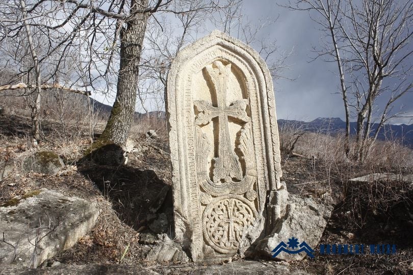
Fig. 1 The Rakhish/Zorakhach (Vazgenashen) khachkar. Photo by S. Danielyan.
The Rock-Cut Crosses of Vazgenashen
The first of the rock-cut crosses lies 1.4 km northwest of the village of Vazgenashen in the Kashatagh District, on the right side of the Vazgenashen–Shalva road, at the confluence of the eponymous streams. In the official Register of Monuments of the Kashatagh District of the Republic of Artsakh, the "Vazgenashen Rock-Cut Cross" is listed under no. 178 and dated to the 15th–16th centuries; its elevation is recorded as 1,270 m (Fig. 2). Several simple crosses are also carved on one of the fragments that has rolled down from the rocky promontory known as Rakhish.
Although no historical or archaeological studies of the monument are presently available, it stands within a landscape dense with cultural remains. Along the margin of a broad, elongated promontory to the north of the rock-cut cross lies one of the surrounding medieval cemeteries, from which only a few tombstones, khachkars, and fragments survive. At a straight-line distance of just 420 m to the northeast is the 14th-century Zorakhach–Rakhish (also known as Vazgenashen) khachkar.
A second cemetery is located 470 m due east of the Vazgenashen rock-cut cross. According to the site's inventory record, the graveyard “Below Rakhish" is dated to the 16th–18th centuries. On site are three plain khachkars, the ruins of a chapel-church, and another rock-cut cross incised with simple crosses (Fig. 3).
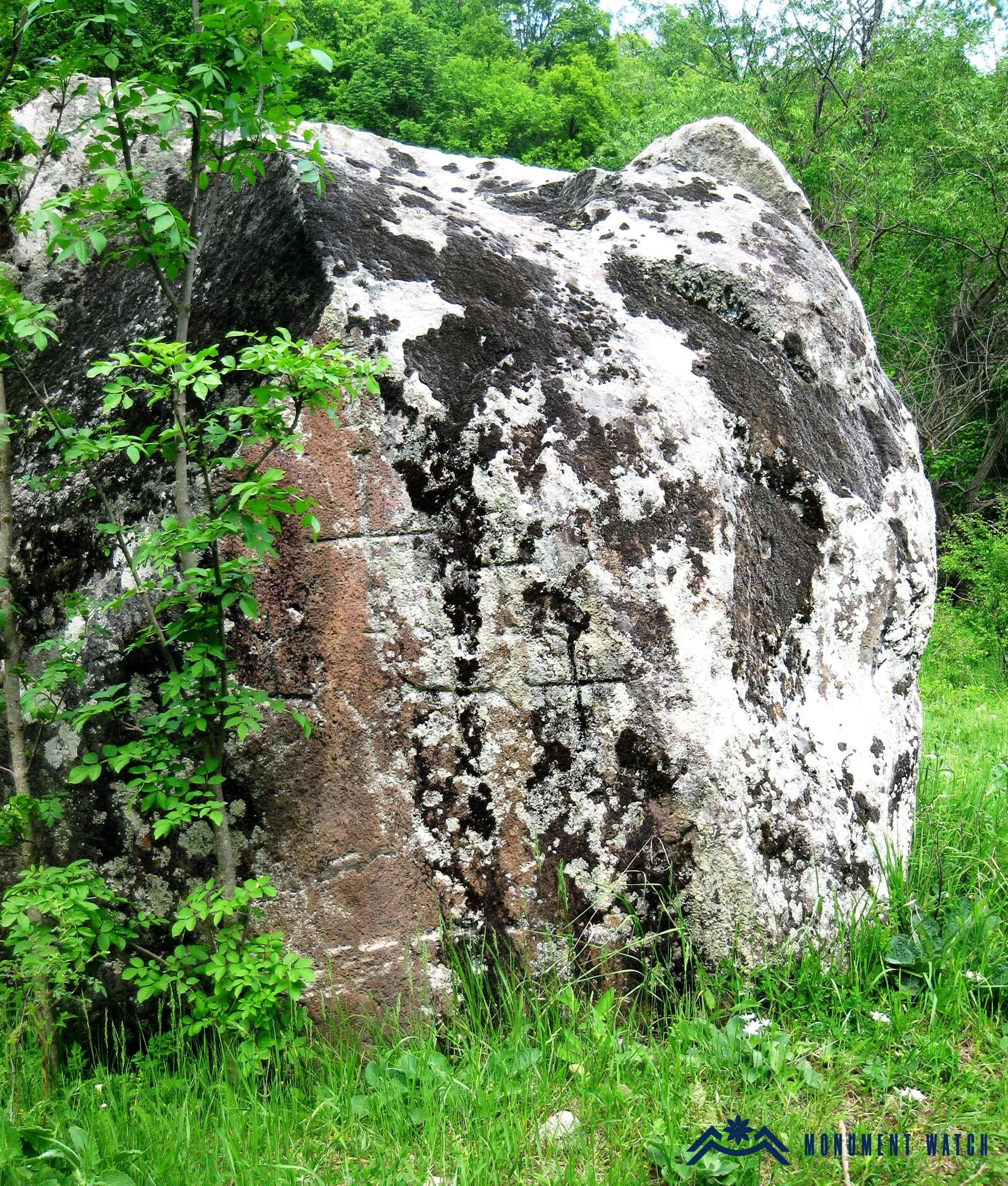
Fig. 2 The rock-cut cross of Vazgenashen. Photo: S. Nalbandyan.
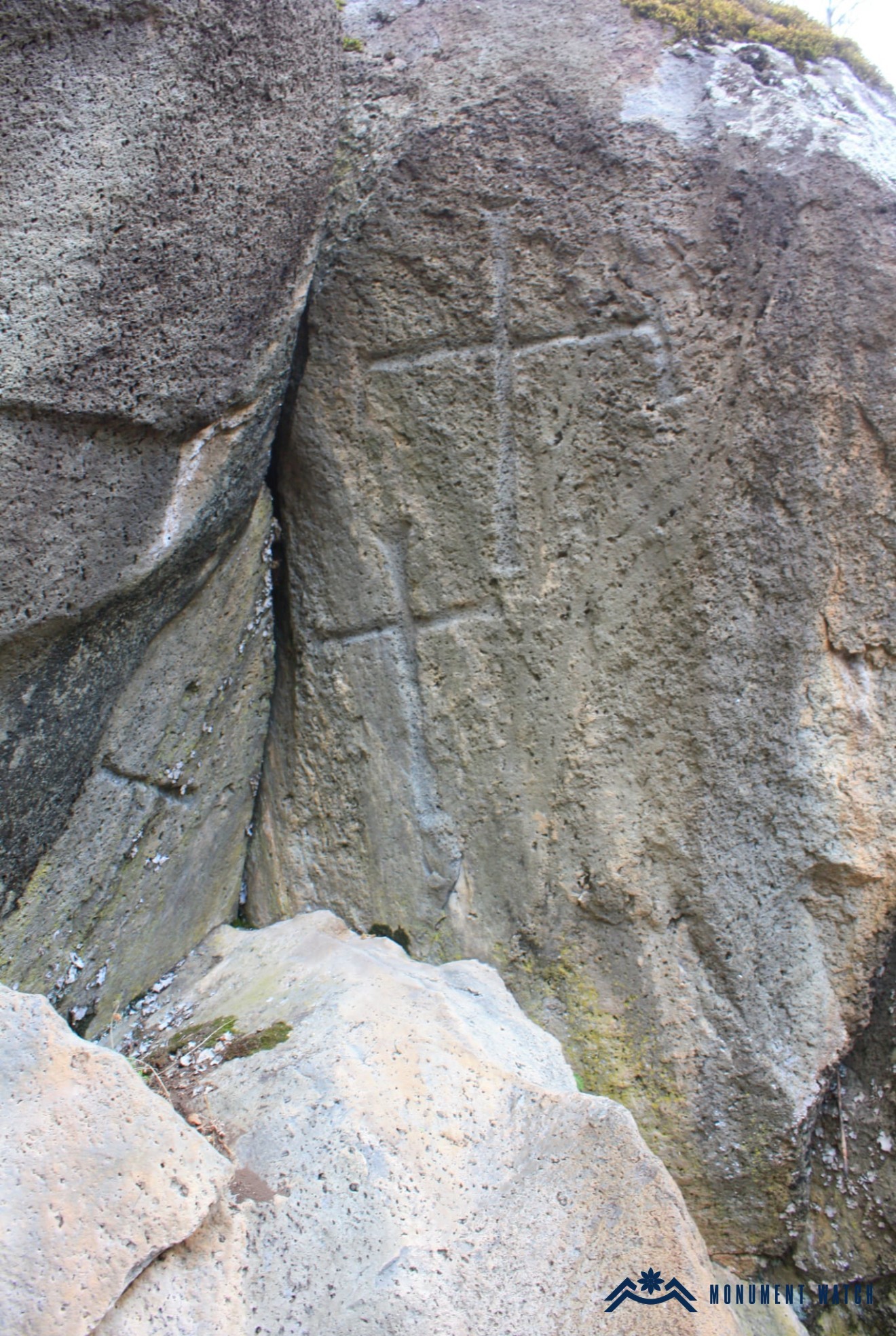
Fig. 3 The rock-cut cross in the cemetery known as “Below Rakhish.” Photo by Z. Erkoyan.
Another cemetery with plain khachkars, dated to the 15th–16th centuries, lies 530 m southeast of the rock-cut cross (in a straight line), within the grounds of Vazgenashen’s large Soviet-era cattle barn.
In addition to the two rock-cut crosses noted above, a third example exists in the region, located approximately 5 km north of Vazgenashen, within the territory of the village of Arakhish. By the composition of its carved crosses, it differs from the other two (Fig. 4).
In general, rock-cut crosses begin to appear from the 12th century onward. In the organization of sacred space, the favorable period following the Seljuk incursions witnessed the emergence of new forms. Belonging to this development, rock-cut crosses are particularly characteristic, in their formative phase, of the upper valley of the Azat River. This cultural phenomenon subsequently spread across nearly all of Armenia; the specimens documented at Vazgenashen are part of this broader pattern (Petrosyan 2006, 251–252).
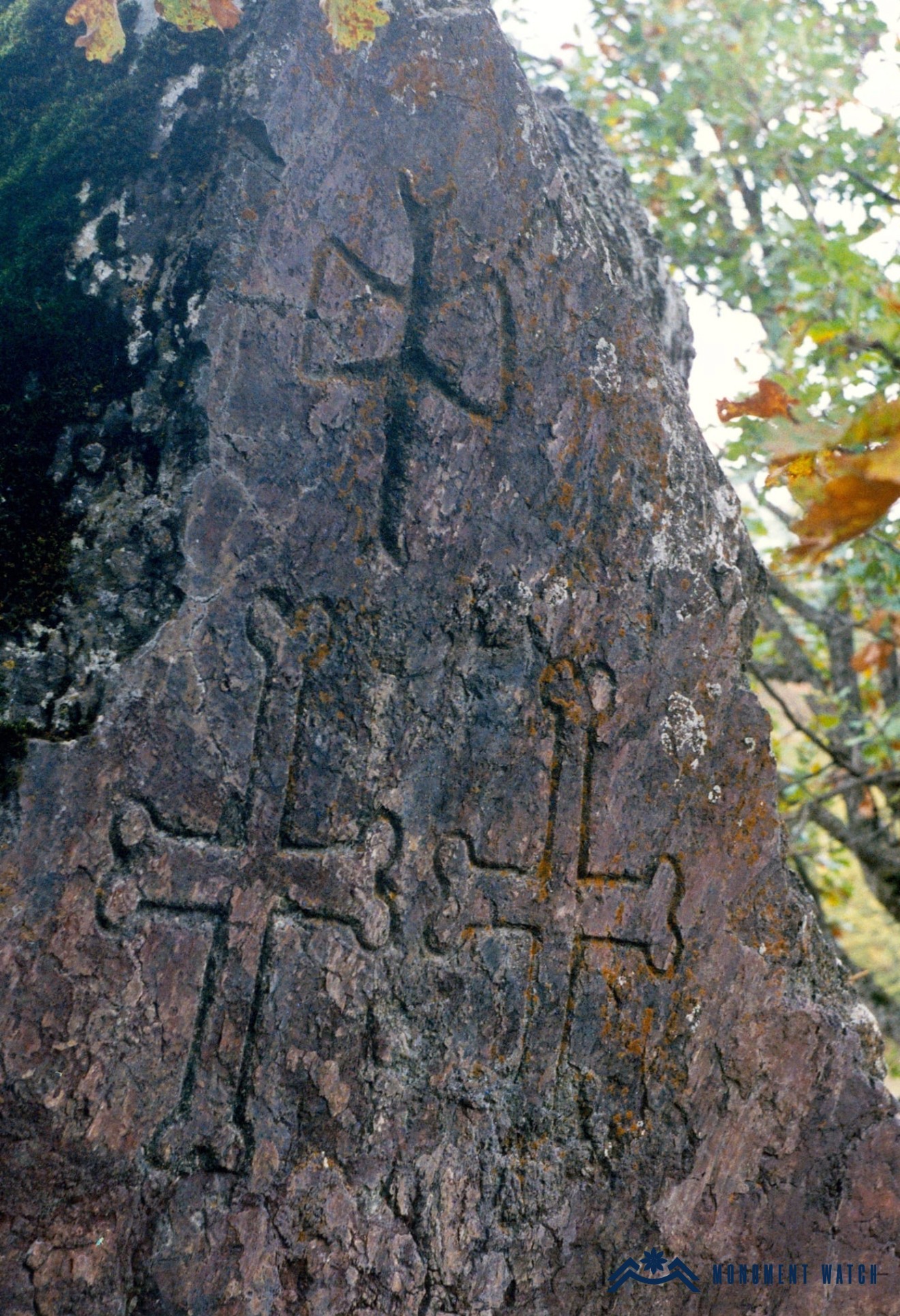
Fig. 4 The rock-cut cross of Arakhish village. Photo by Z. Erkoyan.
Condition Before, During, and After the Wars
During both the Artsakh War and the 44-day war, the monument remained undamaged. Following the occupation of Artsakh and the forcible displacement of the population, however, no information has been available regarding the status of the monuments. On May 31, 2025, the Caucasus Heritage Watch initiative reported that the first rock-cut cross of Vazgenashen, along with its immediate surroundings, had been destroyed during earth-moving operations.
Bibliographic Examination
The photograph used by L. Hovhannisyan in the monument’s official registration dossier cannot be matched to the aforementioned earlier photographs taken by other authors (Fig. 5).
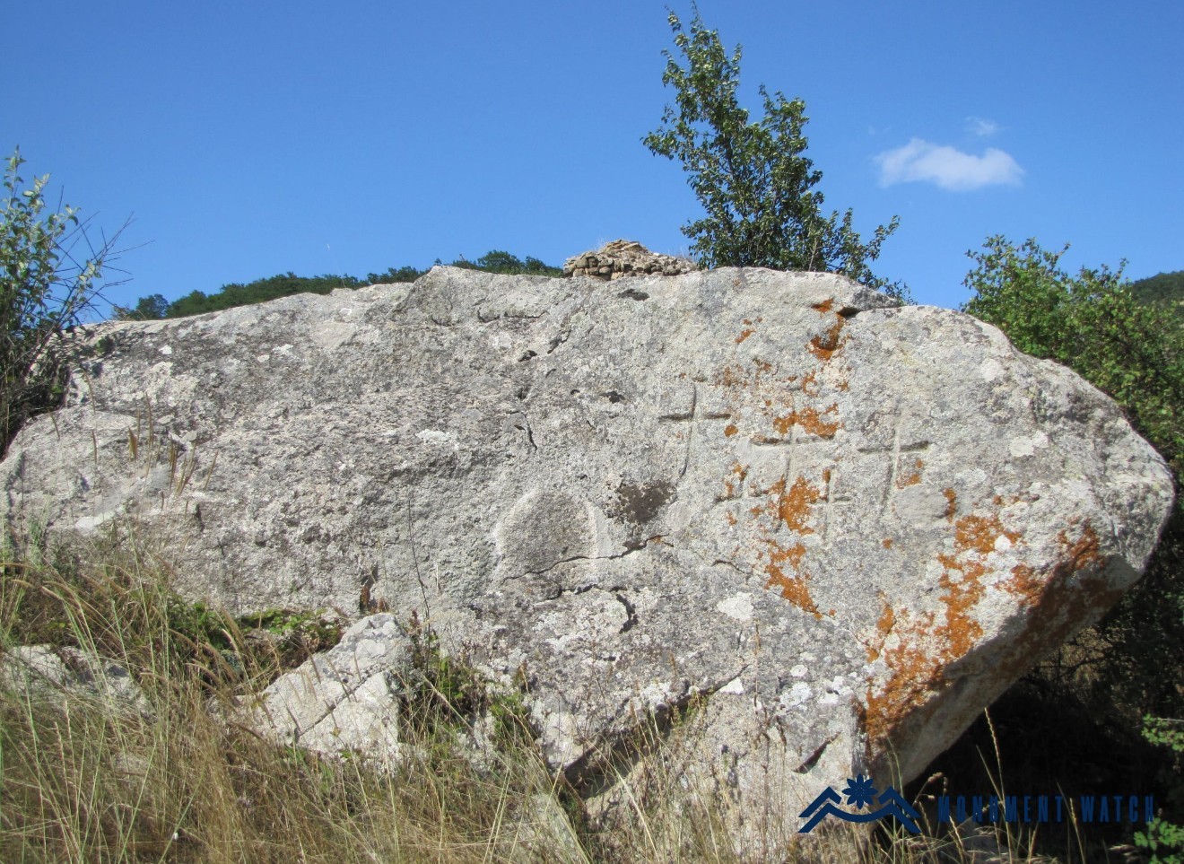
Fig. 5 The Vazgenashen rock-cut cross, as reproduced in the List of Monuments of the Republic of Artsakh. Photo by L. Hovhannisyan.
Bibliography
- Petrosyan, Hamlet. 2006. “The Role of Khachkars in the Organisation of a Sacred Landscape (on the Example of Monuments in the Valley of the River Azat).” In Mythical Landscapes Then and Now: The Mystification of Landscapes in Search for National Identity, Yerevan, 251–255. (In Russian.)
- Certificate of the Ministry of Education, Science, Culture, and Sports of the Republic of Artsakh.
The Rock-Cut Crosses of Vazgenashen
Artsakh