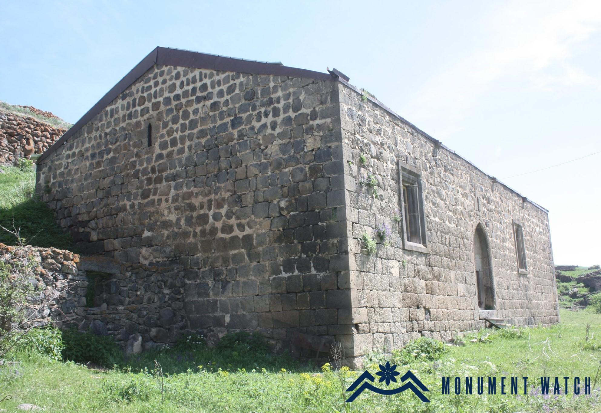
St. Minas Church of Hak
Location
The church is located in Hak (Minkend) village of Kashatagh region (Lachin region) of the Artsakh Republic. The village is located on the left bank of the Aghavnaget River, 1720-1800 meters above sea level (Karapetyan 1999, 128).

Historical overview
The village is first mentioned by the 13th century historian Stepanos Orbelyan as a village located in the north-eastern part of historical Syunik – a village of Aghahetchk canton bordering on historical Artsakh, which was tributary to Tatev Monastery (Hakobyan, 1960, 209). It paid 15 units in taxes to the monastery (Orbelyan, 1910, 516). The folk etymology of the name Minkend (Turkish: literally a thousand villages) is linked to a legend, according to which it was the 1000th settlement destroyed during the invasion of Tamerlane (Ghanalanyan, 1969, 172). The village was inhabited by Armenians until the beginning of the 18th century, later it was depopulated of Armenians. Instead, Kurds settled here. Only in 1841 did the Armenian population again return to the village, when the Armenians who had moved from Khndzoresk village settled in the village thus living in a separate district. The Armenian population suffered significantly during the 1905 Armenian-Tatar clashes, and in 1918 the village was finally depopulated of Armenians. During the Soviet years, the population of the village presented Turkified Kurds (Karapetyan 2001, 129-130).
Architectural-compositional description
St. Minas Church is located in the center of the village (Figs. 1, 2).

Fig. 1 The general view of the church, photo by H. Abrahamyan.

Fig. 2 The general view of the church, photo by R. Matevosyan.
By its plan it is a three-nave basilica-type vaulted church with a gable roof (Fig. 3).

Fig. 3 The church plan, S. Karapetyan, Armenian cultural monuments in the region of Karabakh, Yerevan, 2001, p. 127.
In the east it ends with a semicircular altar and adjacent vestries. It has extensive dimensions (22.58x12.60 m). It is built of wrought gray-yellowish polished and rough stones and lime mortar. The only entrance is on the southern side (Fig. 4). It is arrow-shaped, with a frame decorated with oblique cylinders. The building inscription engraved on the rectangular lintel reads: “This newly-baptized (newly consecrated) holy church was built by people of Hak. In the year of 1675” (CAI, 1982, 194). The third line of the inscription is scratched for an unknown reason. Near the right corner of the epigraph is engraved the date “1673” in a typical style of the 19th century (Fig. 5). In the 19th century, the church is sometimes referred to as St. Gevorg. The church started functioning as the parish church of Hak since 1858. It is probable that the southern pair of windows was also transformed and expanded at this time.

Fig. 4 The main entrance of the church, photo by H. Abrahamyan.

Fig. 5 The building inscription of the church, photo by H. Abrahamyan.
The condition before and after the war
The church used to be in a state of disrepair during the Soviet era. It did not suffer during the Artsakh wars. Sponsored by Virginia Davis, it was renovated in 2009 by the Tufenkian Foundation and was re-consecrated in the same year. After the Azeri takeover of Kashatagh region in December 2020, the church was still standing, the lintel inscription of the entrance was on its place.
Bibliography
- Corpus of Armenian Inscriptions, Release 5, Artsakh, Yerevan, 1982.
- Karapetyan S., Armenian cultural monuments in the region of Karabakh, Yerevan, 2001.
- Hakobyan T., Outlines of the historical geography of Armenia, Yerevan, 1960.
- Ghanalanyan A., Armenian traditions, Yerevan, 1969.
- Stepanos Orbelyan, History of the Province of Syunik, Tiflis, 1910.
Հակ
Արցախի Հանրապետություն