St. Stepanos Church of Harar
Location
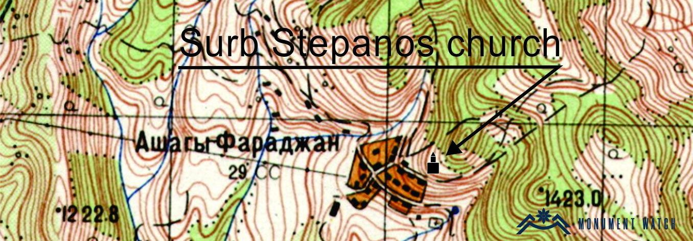
The church is located in Harar village of Kashatagh region (Lachin region) of the Artsakh Republic, which together with Khachgetik and Aghavnatun villages is part of Aghavnatun rural community. Harar village is located on the left bank of the Hakari River, at an altitude of 1180-1280 meters (Karapetyan 2001, 172).
Historical overview
We have written evidence of Harar village since the 17th century. The village is mentioned in the colophons of the manuscripts created locally, where St. Stepanos Church of the village is mentioned as the place of creation of the manuscripts. The next mention of Harar dates back to the 19th century. Accordingly, the majority of the village population was Armenian. The village suffered significantly during the 1905 Armenian-Tatar clashes and especially in 1918. By the 1930s, the village had been depopulated of Armenians and Turkish-speaking Kurds and Azeris had settled on the site (Karapetyan 2001, 172-173).
Architectural-compositional description
St. Stepanos Church of the village is located at the eastern end of the village, on a steep hillside, it is half-ruined (Fig. 1).
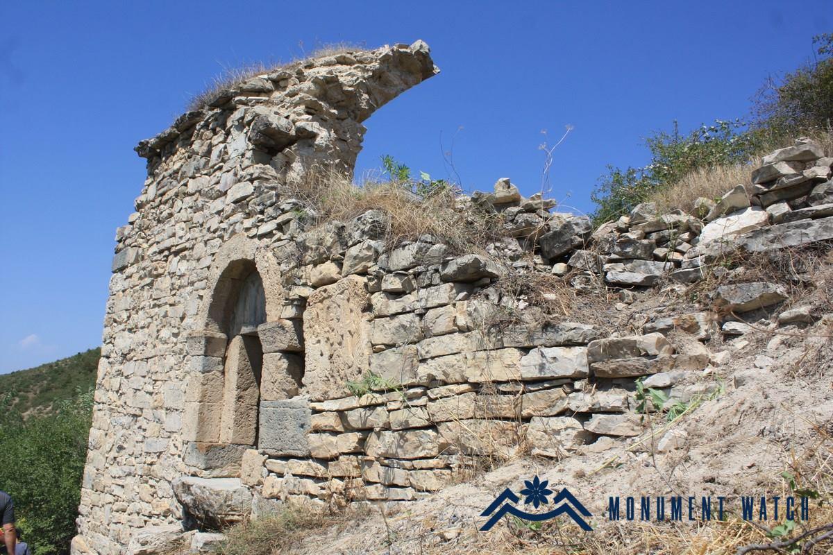
Fig. 1 The general view of the church, photo by Z. Rkoyan.
The church was built of rough stones and lime mortar in the 16th-17th centuries on the site of an older church, it lacks any building inscriptions. The same church is mentioned as St. Hripsime in the documents dated 1841 and later (Karapetyan 2001, 175). Presently, the southern and partly western walls of the church are standing, the segment of the altar can be outlined (Fig. 2). According to the plan, it is a single nave church (Fig. 3) which used to be vaulted, the sole entrance is from the south. The church has no vestries. A gravestone with a cross-carved surface is embedded onto the entrance as a lintel (Fig. 4). A khachkar is embedded close onto the entrance (Fig. 5), on which the traces of a severely distorted inscription are noticed: “I erected this cross as intercession to for my mother Tu…” (Karapetyan 2001, 175).
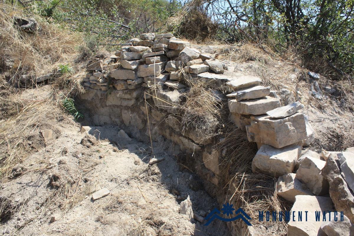
Fig. 2 The segment of the church altar, photo by Z. Rkoyan.
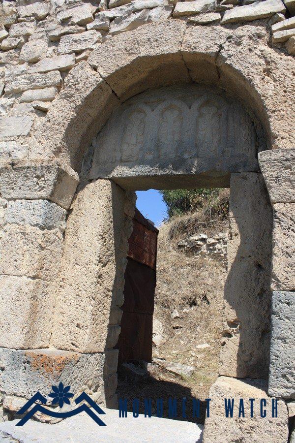
Fig. 4 The entrance of the church, photo by Z. Rkoyan.
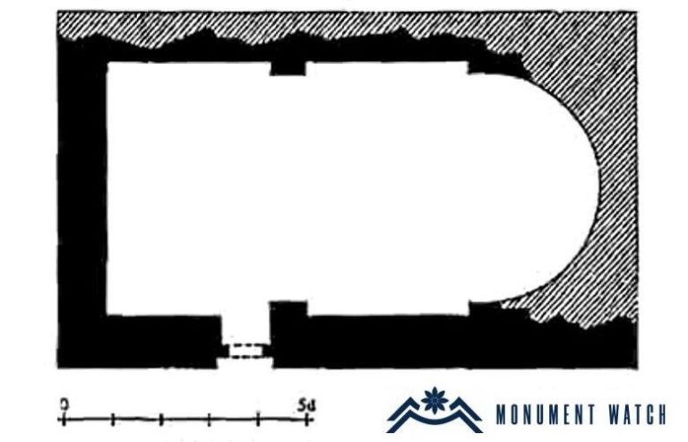
Fig. 3 The church plan, S. Karapetyan, “Armenian cultural monuments in the region of Karabakh,” p. 175.
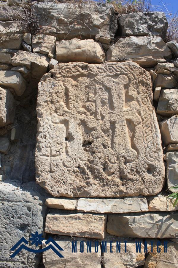
Fig. 5 The khachkar embedded close onto the entrance of the church, photo by Z. Rkoyan.
The condition before and after the war
Already at the end of the 19th century, the church building was in a state of disrepair. Many church stones, as well as most of the gravestones in the Armenian cemetery of the village, were used to build various buildings by Turkish-speaking Kurds and Azeris who settled in the village during the Soviet era.
After the transfer of Kashatagh region under the Azerbaijani control in December 2020, changes and destruction in the area of the monument have not been documented so far.
Bibliography
- Karapetyan S., Armenian cultural monuments in the region of Karabakh, Yerevan, 2001.
St. Stepanos Church of Harar
Artsakh