The Excavations of Berdashen

The 2019 archaeological investigation at the foot of the fortress and its surroundings

In July–August 2019, a detachment of the Artsakh Archaeological Expedition carried out excavations at the foot of the fortress of Berdashen village in the Martuni District of the Republic of Artsakh, as well as in the vicinity of the Pitsi Nahatak Chapel. The village is currently occupied by Azerbaijan.

The aim of the excavations was to initiate a systematic archaeological investigation of the village fortress, known as Berd or Pyort, and its surroundings. This work was intended to clarify the site’s historical significance and to address the community’s strong interest in cultural heritage and antiquities research.

The former and present names of the village — Berdashen, Ghzghala, Kalakend-Karakend-Aghjikaberd — are closely connected with the medieval fortress located on the northern outskirts of the village. On its summit, traces of defensive walls, a reservoir, and residential-economic complexes have been preserved. Decades of “excavations” carried out there had resulted in the creation of the village museum. Since the available resources allowed only for test excavations, following an archaeological survey, it was decided to conduct test excavations at the south-western foot of the fortress and in the area of the monument dedicated to the Great Patriotic War, where early Christian monuments had been found. About thirty years earlier, some of these monuments had been reused in the construction of a chapel next to the memorial, on the site of the sanctuary known as Pitsi Nahatak.

The excavations were financed by the Ministry of Culture, Youth Affairs and Tourism of Artsakh and the Berdashen Charitable Foundation.

At the foot of the fortress

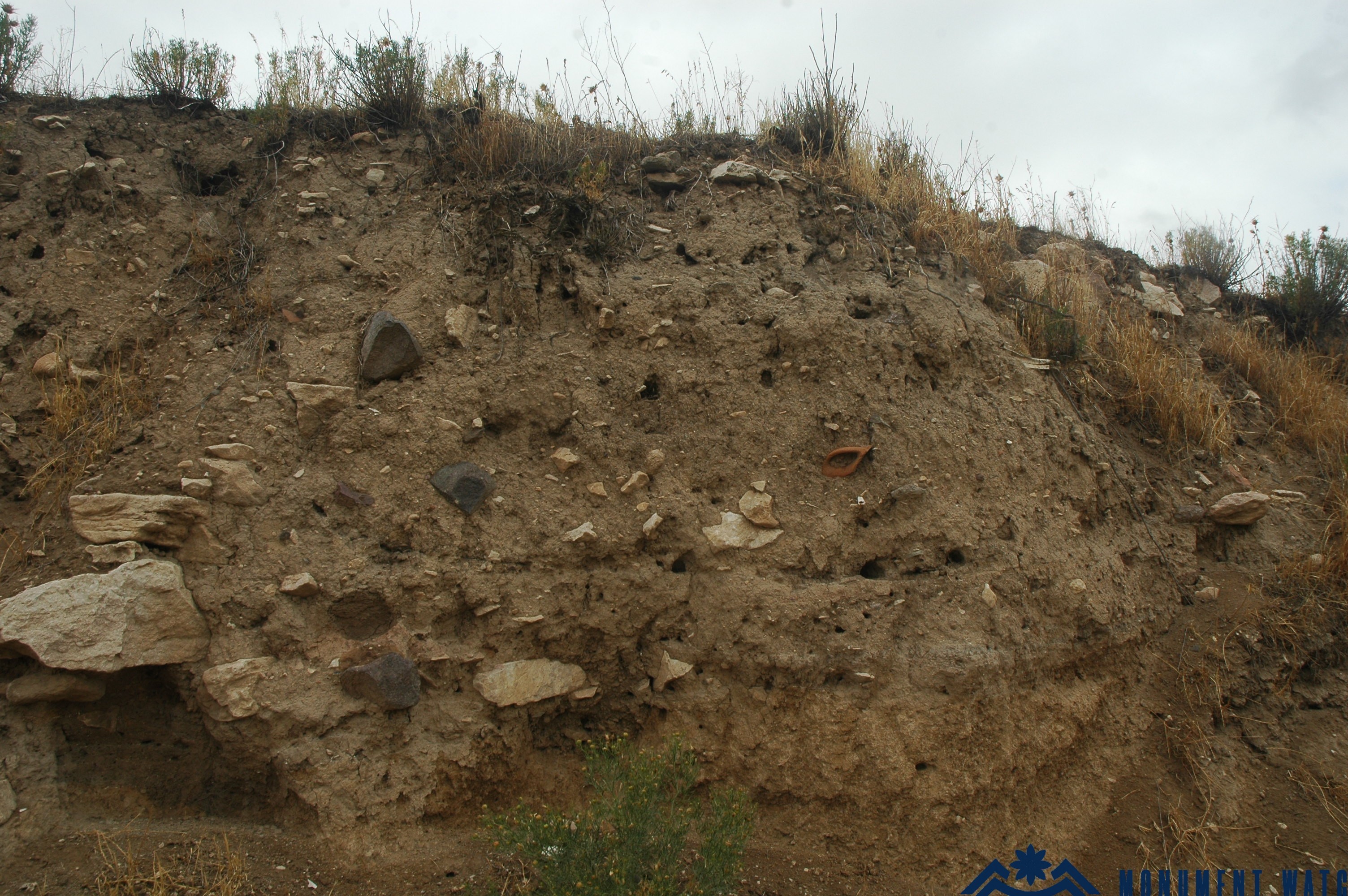
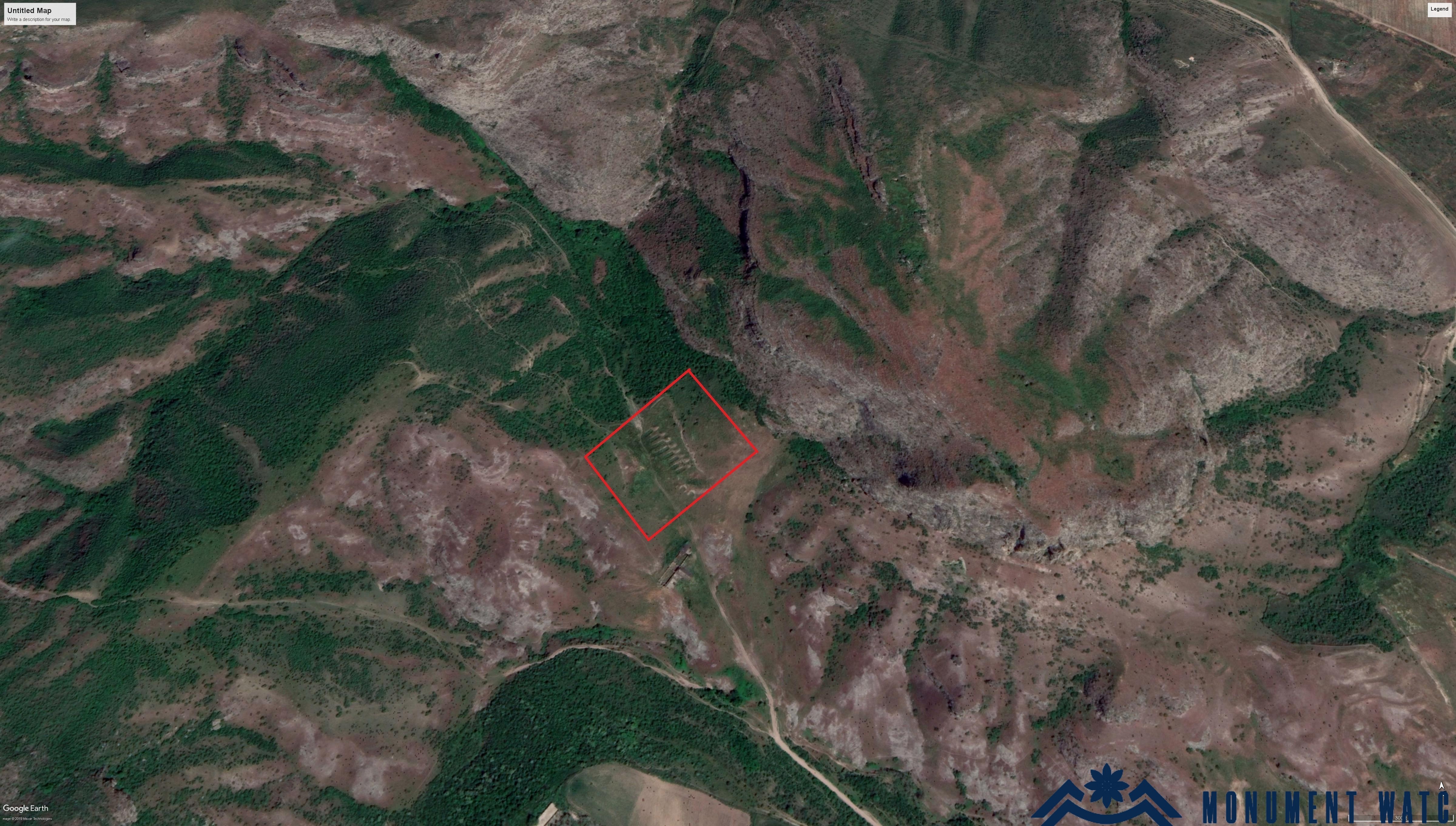
In the south-western part of the quarter conventionally referred to by us as the foot of the fortress (Fig. 1), where cultural layers up to two meters deep are visible in soil sections created by excavations from the Soviet period (Fig. 2), nine squares measuring 5 × 5 m were laid out. Test excavations were carried out in six of them: A1, A2, B1, B2, C1, and C2.

Fig. 1. The general view of the lower quarter of Berd according to Google Earth. Photo: Artsakh Archaeological Expedition.

Fig. 2. A section of the cultural layer in the quarter at the foot of Berd. Photo: Artsakh Archaeological Expedition.

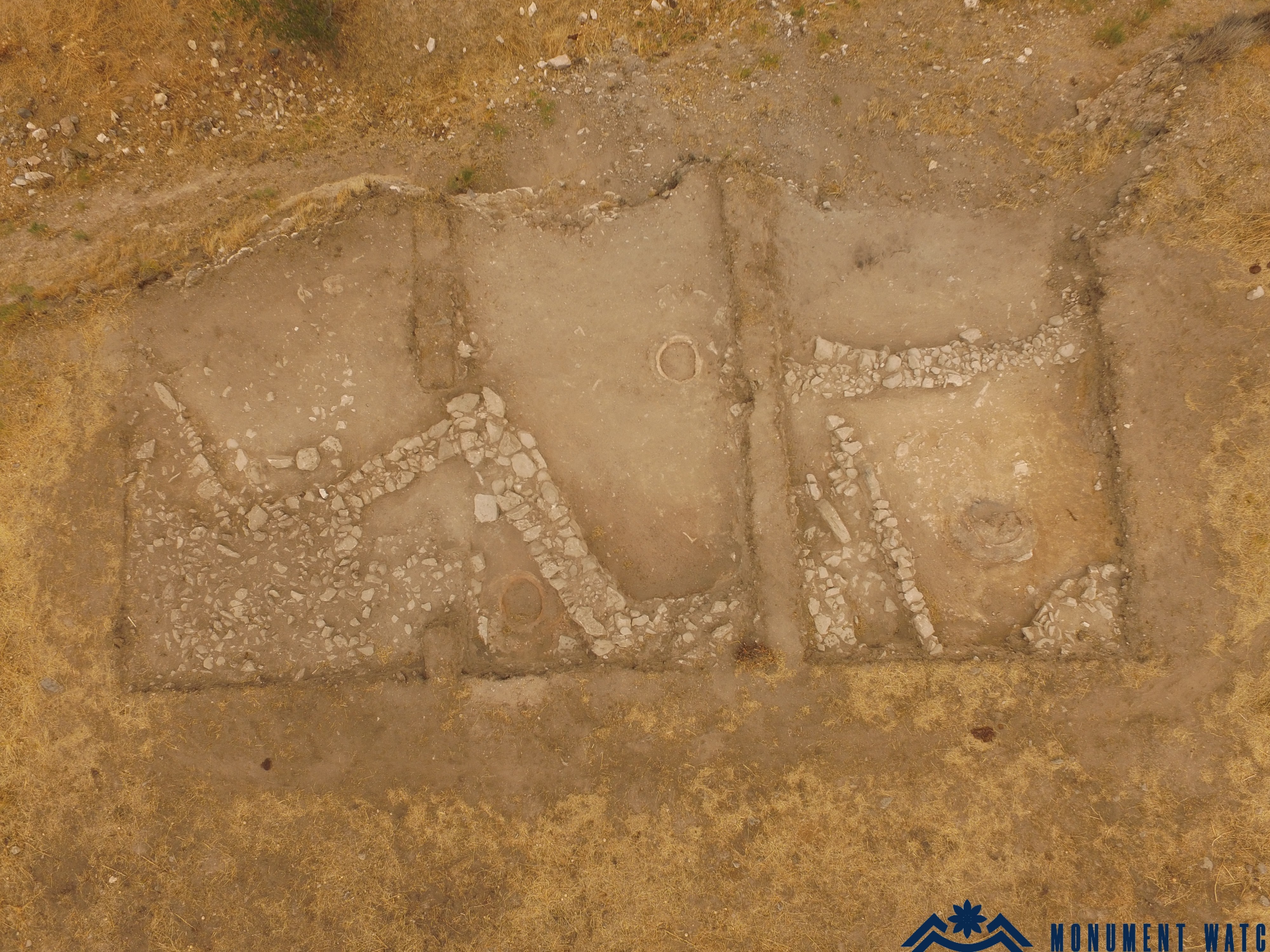
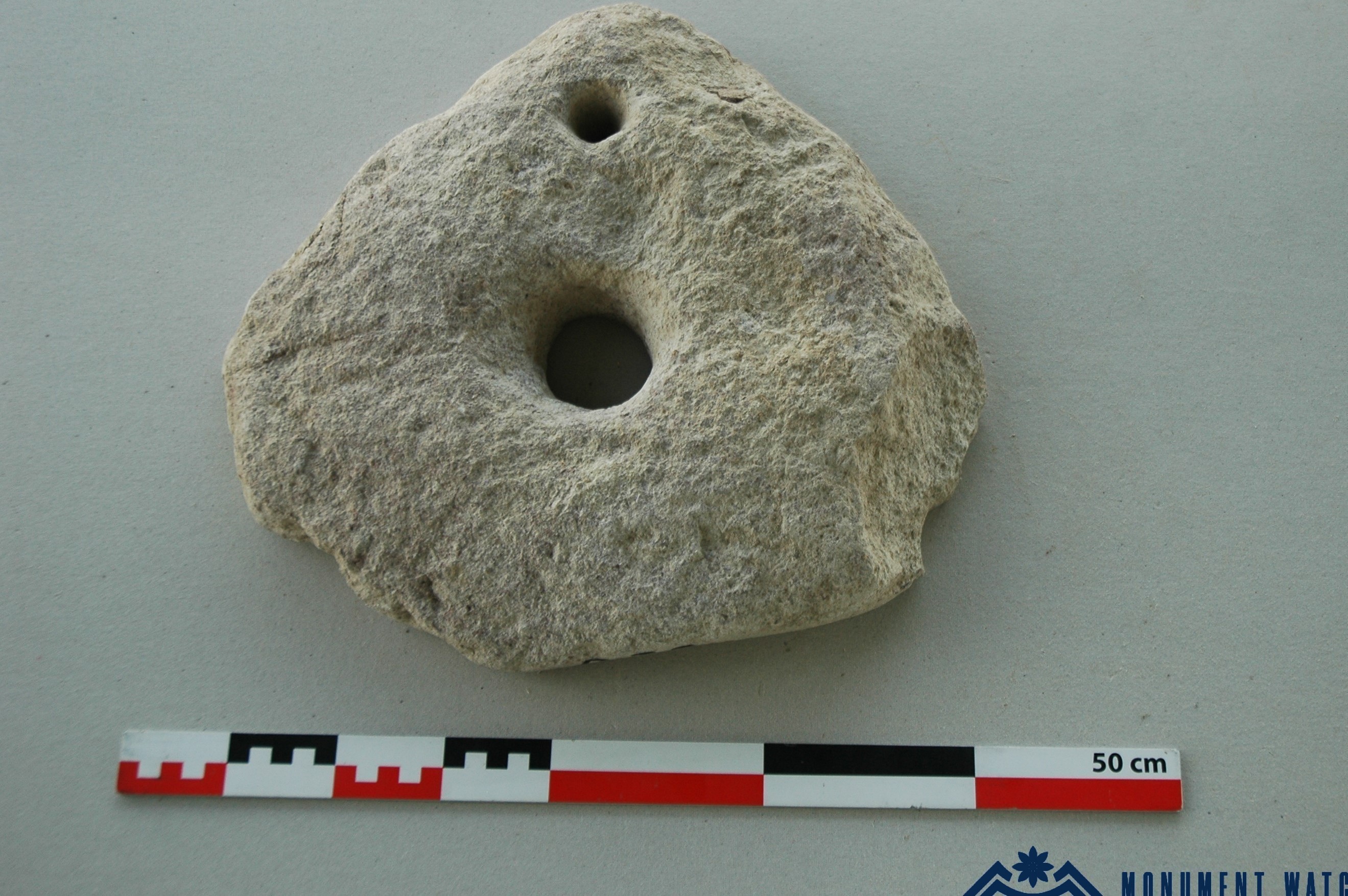
As a result, separate parts of three semi-subterranean residential-economic complexes were uncovered. These structures had irregular plans and walls built of fragmented stone bonded with clay mortar (Fig. 3). A tonir formed an essential component of each complex. In the first complex, the upper stone of a hand-mill was found (Fig. 4).

Fig. 3. View of the excavated area from above. Photo: Artsakh Archaeological Expedition.

Fig. 4. The upper stone of a hand-mill. Photo: Artsakh Archaeological Expedition.

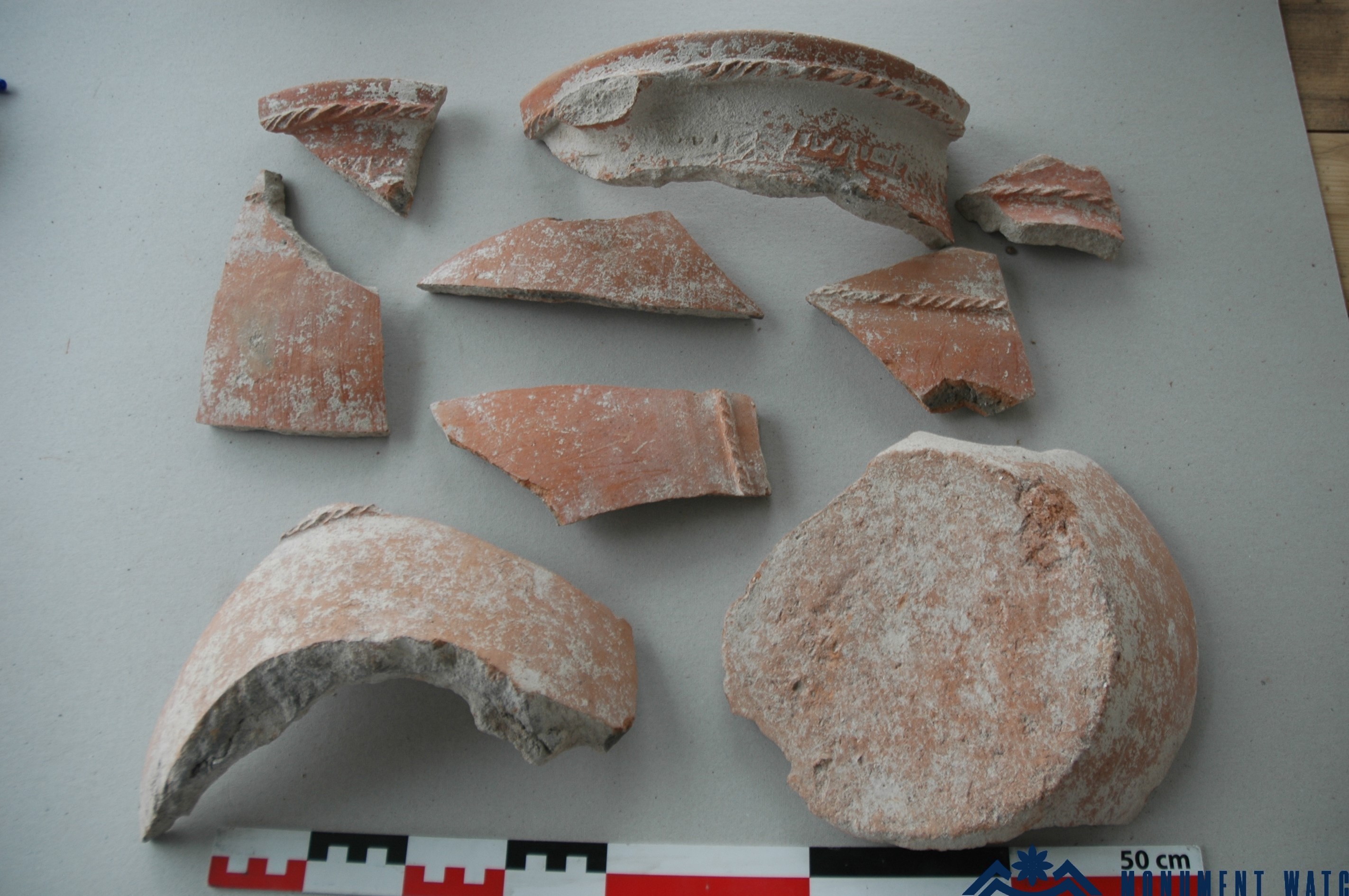
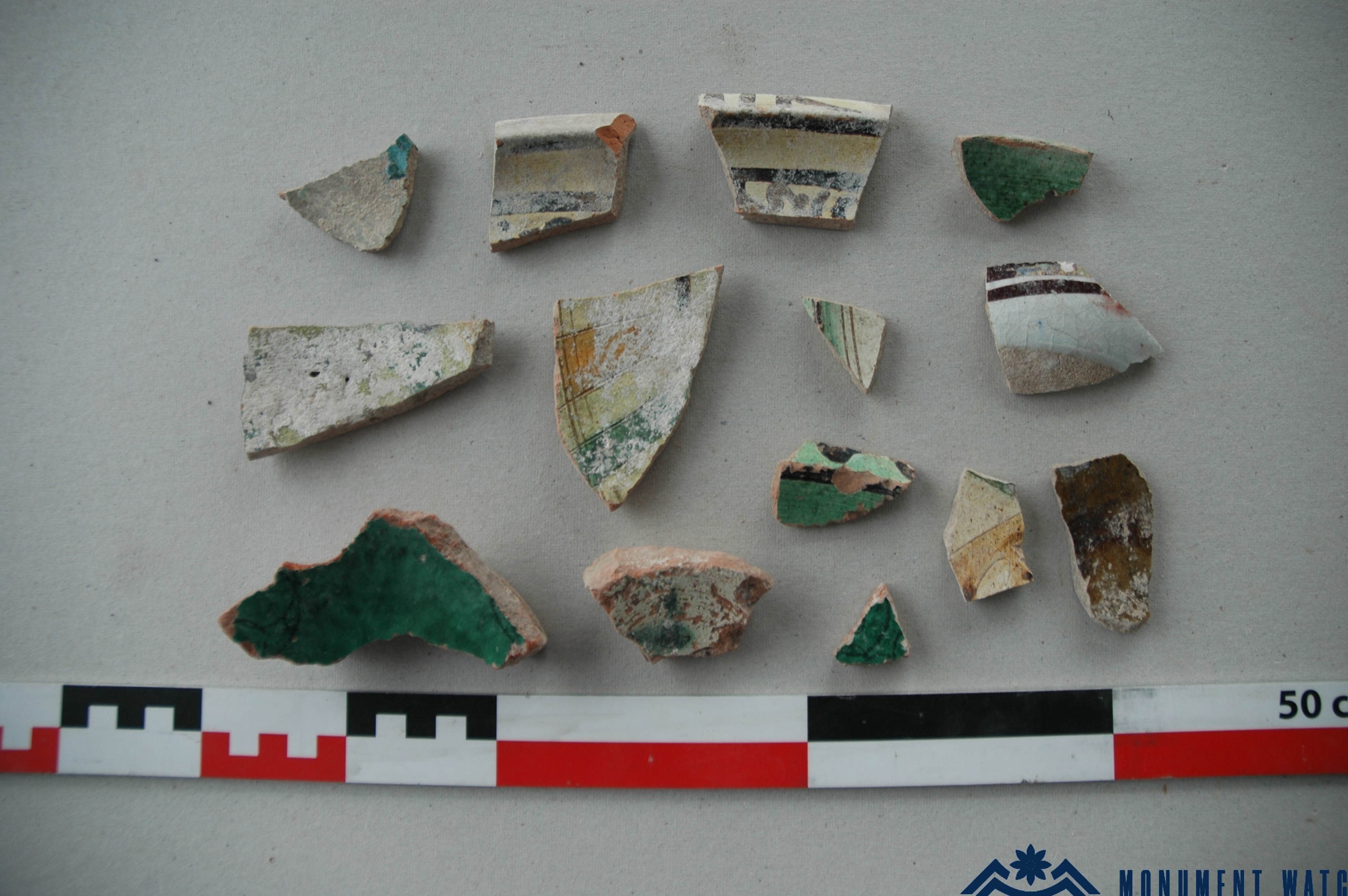
The materials discovered during the excavations were mainly fragments of ceramic vessels dating to the 11th–13th centuries. Among them were a certain number of fragments of stamped pithoi (Fig. 5), as well as pieces of mould-decorated and glazed ceramic vessels (Fig. 6). Fragments of glass bracelets, one copper coin, and other finds were also discovered. Such archaeological materials are generally components of urban culture and indicate the settlement’s involvement in the economic and cultural developments of the region, a feature characteristic of village-towns located along trade routes.

Unfortunately, there is no direct information about Berd in medieval written sources. Moreover, the inscribed parts of two fragments of an early Christian sculptured slab originating from the site — preliminarily dated to the 6th–9th centuries — unfortunately contain neither personal names nor place names.

Among the finds there are also ceramic fragments dating to the 9th–10th and 17th–18th centuries. Both among the excavated materials and the surface finds collected during exploratory work in the surrounding area, fragments of black-surfaced ceramics are present; these may be dated from the beginning of the 1st millennium BC to the Antique period.

Based on the excavations at the foot of the fortress and the investigation of its surroundings, it may be concluded that the area is apparently a quarter at the southern foot of Berd. This quarter extended across the entire southern flat area at the foot of the fortress, occupying approximately 1.5 hectares. The evidence shows that it was actively inhabited in the 11th–13th centuries, with occupation continuing until the 17th–18th centuries.

Fig. 5. Fragments of stamped pithoi. Photo: Artsakh Archaeological Expedition.

Fig. 6. Fragments of glazed ceramics, 11th–13th centuries. Photo: Artsakh Archaeological Expedition.

Pitsi Nahatak

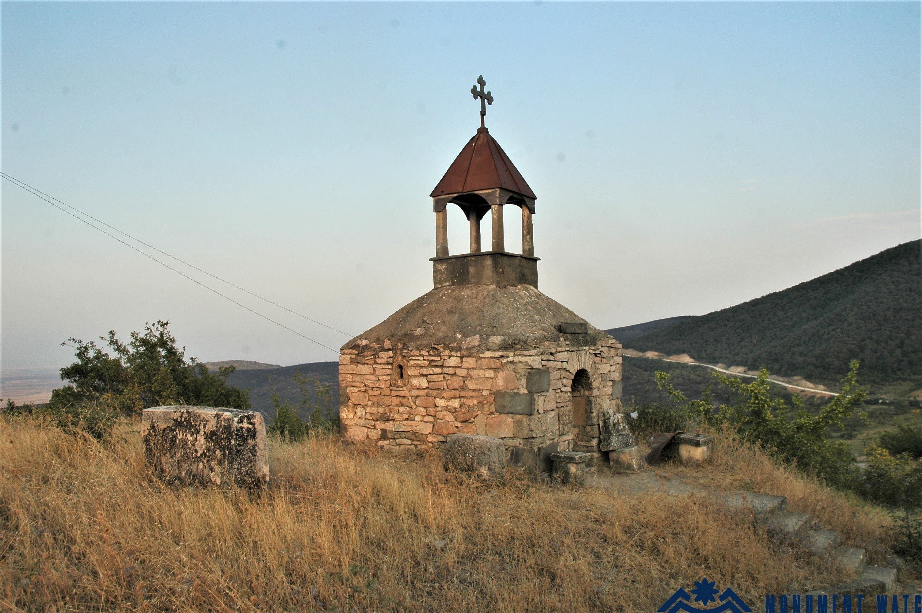
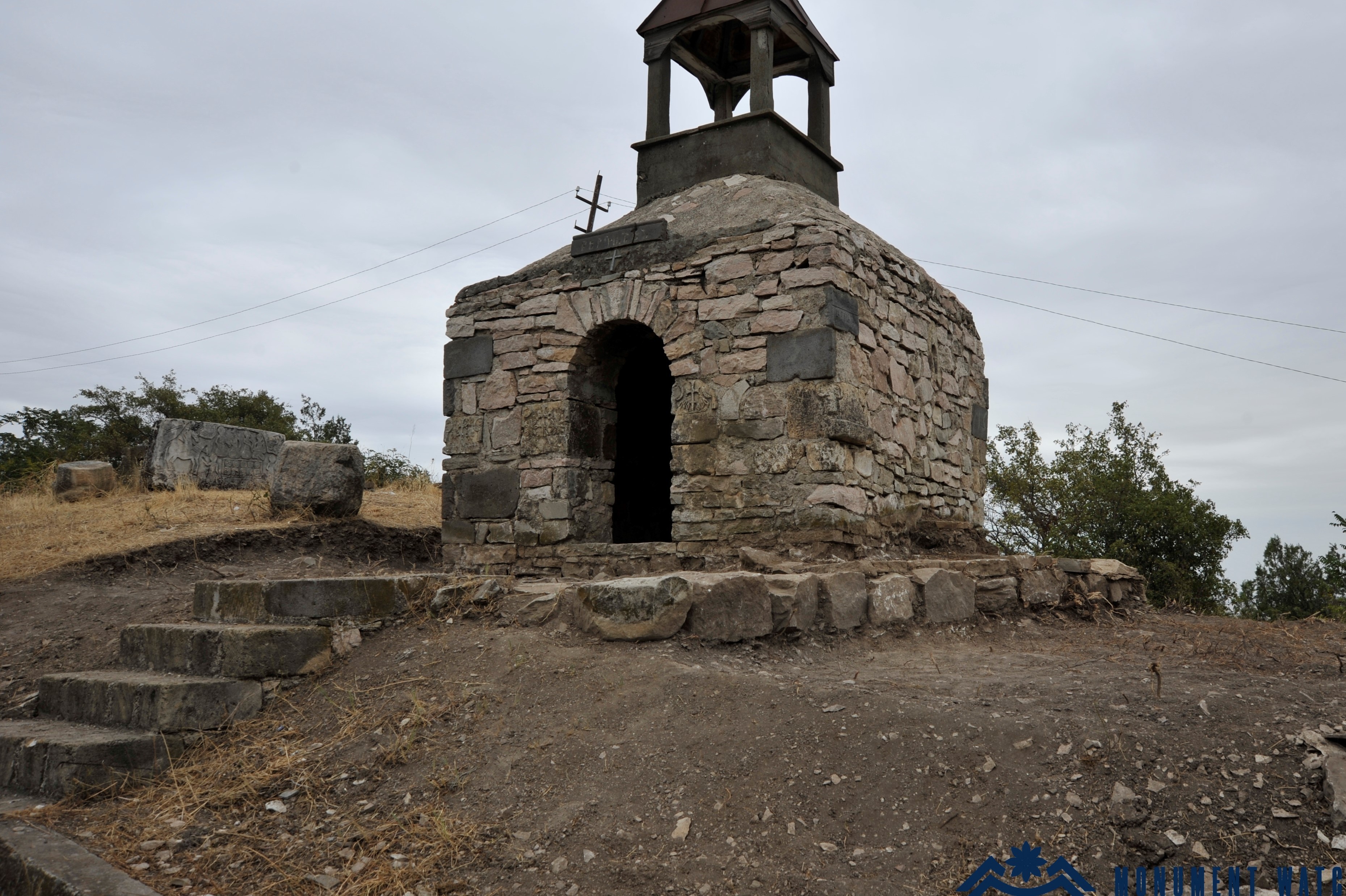
The research also included the area around the small chapel located next to the memorial complex dedicated to the Great Patriotic War in the village of Berdashen, Martuni District of Artsakh (Fig. 7).

As early as the Soviet period, during construction work on the memorial complex, remains of thick walls built of finely dressed limestone were discovered in this area, along with a number of architectural and sculptural details from early Christian structures and monuments, including bases, capitals, and cross-bases (Petrosyan 2008, 34, 64–65). Inside the chapel, there are also two khachkars dating to the 12th–13th centuries, while two tombstones of the 16th–17th centuries, originating from different places, are placed to the north of the chapel.

Fig. 7. The chapel and its surroundings before the excavations, viewed from the north-west. Photo: Artsakh Archaeological Expedition.

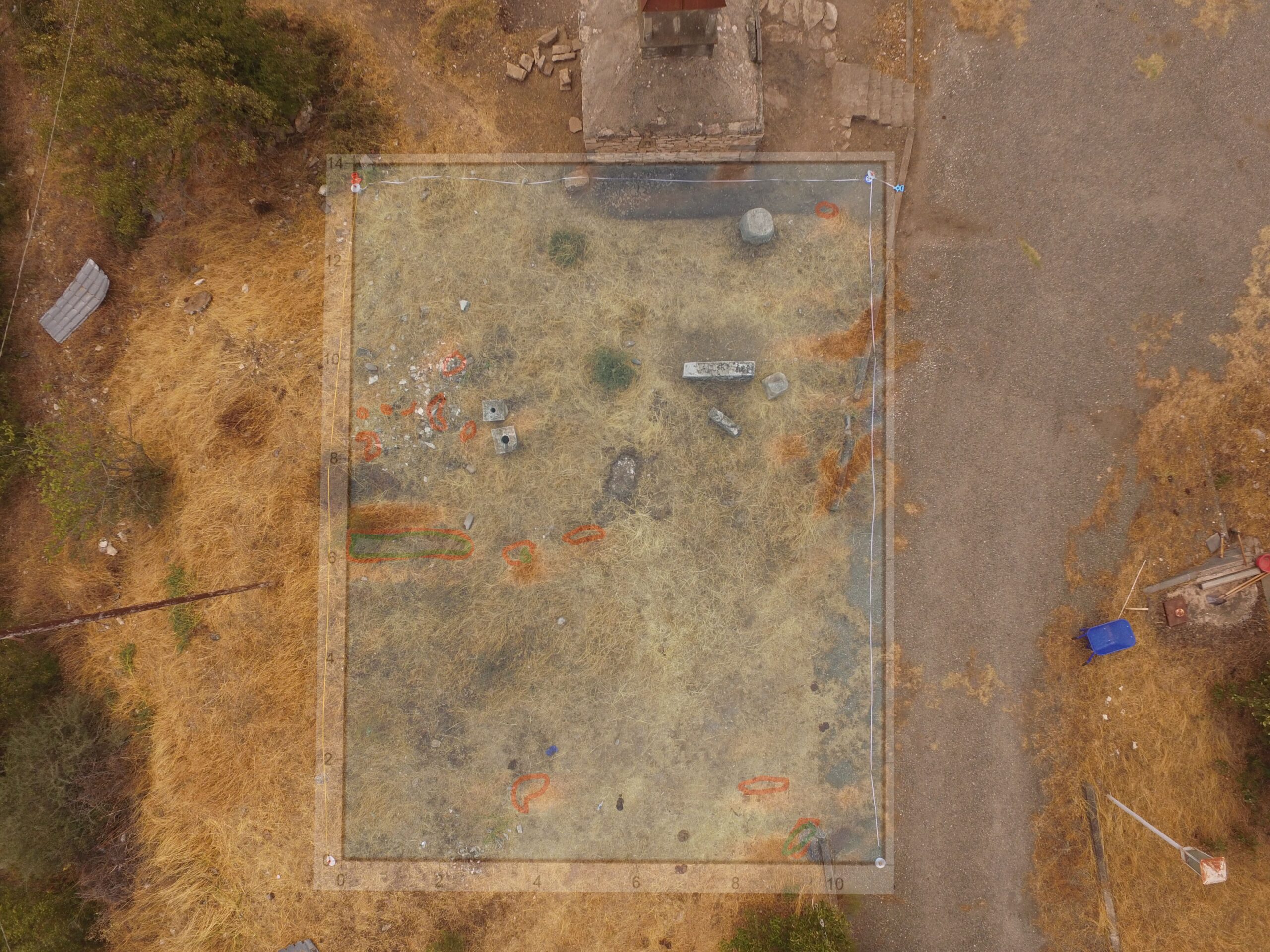
Alongside the excavations, a magnetic survey was also conducted on the upper part of the flat area. We express our gratitude to Arshaluis Mkrtchyan, researcher at the Institute of Archaeology and Ethnography of the National Academy of Sciences of the Republic of Armenia, who carried out both this survey and the drone photography of the excavation area and the foot of Berd. The survey recorded a transversely extending wall immediately behind the monument, near the reservoir, and remains of stone accumulations next to the chapel. The excavation of the wall, which would require a large-scale intervention, was left for the future. As the excavations clarified, the stone accumulations next to the chapel (Fig. 8) were modern construction remains from the building of the present-day chapel.

Fig. 8. The scanning scheme of the northern courtyard of the chapel. Photo: Artsakh Archaeological Expedition.

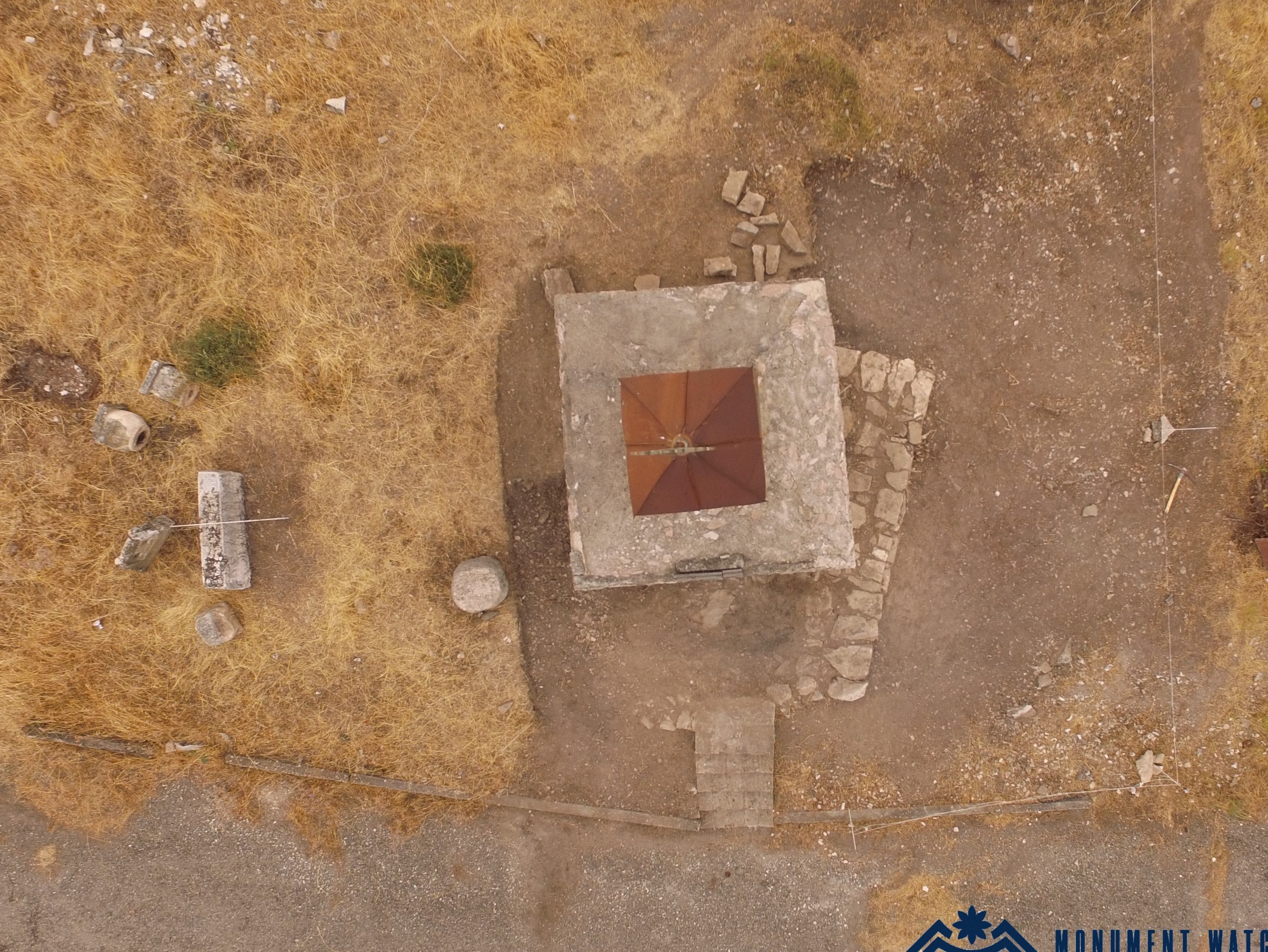
During the excavations, the area adjacent to the chapel was cleared of vegetation, as well as a large quantity of construction and household waste. At a depth of 0.60 m next to the southern and western walls of the new chapel, a platform built of large semi-roughly hewn stones was uncovered (Figs. 9, 10). It consists of two rows of stones: the lower ones are large and roughly hewn, while the upper ones are comparatively smaller. The length of this wall is 4.20 m; its widest part measures 1.50 m, and its narrowest part 1.20 m. The stones in the front section extend almost parallel to the chapel, but from the middle they begin to deviate.

The stones of the platform are also present in front of the chapel entrance, but they do not continue toward the north. The excavations showed that on all other sides the chapel rests directly on natural soil and limestone bedrock, which was exposed on all sides.

During the construction of the chapel, the construction area was covered with concrete, including the platform, and the chapel walls, consisting of large and small stones, were laid upon it. According to local residents, the platform was not visible during construction. In several places, stones from the platform had been removed, and concrete was poured in their place. Excavations inside the chapel showed that its floor consisted of compacted earth, while the southern wall was placed directly on the platform. In the remaining sections, the platform was not observed. During the excavations, natural soil and bedrock were exposed at a depth of 0.40–0.60 m.

It may be concluded that this platform represents the original platform of Pitsi Nahatak itself, and that as a result of Soviet-period leveling works and the construction of the new chapel, this is the only element that has survived from the earlier structure. In fact, it is impossible to determine what early Christian structures once stood here and what relation the sculptured stones that have reached us had to them. Archaeological material is almost absent: only a few fragments of medieval common pottery and two large fragments of roof tile were found.

The exploratory work shows that a more thorough investigation of Berd requires serious financial investment and organizational effort. It is hoped that regular excavations will make it possible not only to reconstruct the medieval appearance of the settlement, but also to turn the research, public presentation, and museumification of cultural heritage into an integral part of the community’s cultural life.

Fig. 9. The newly uncovered platform, viewed from above. Photo: Artsakh Archaeological Expedition.

Fig. 10. The area adjacent to the chapel after the excavations, viewed from the south-west. Photo: Artsakh Archaeological Expedition.

Bibliography

  1. Petrosyan 2008 - Petrosyan H., Khachkar: Origin, Function, Iconography, Semantics, Yerevan, Printinfo.
The Excavations of Berdashen
Artsakh