Katosavank Monastery

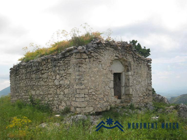
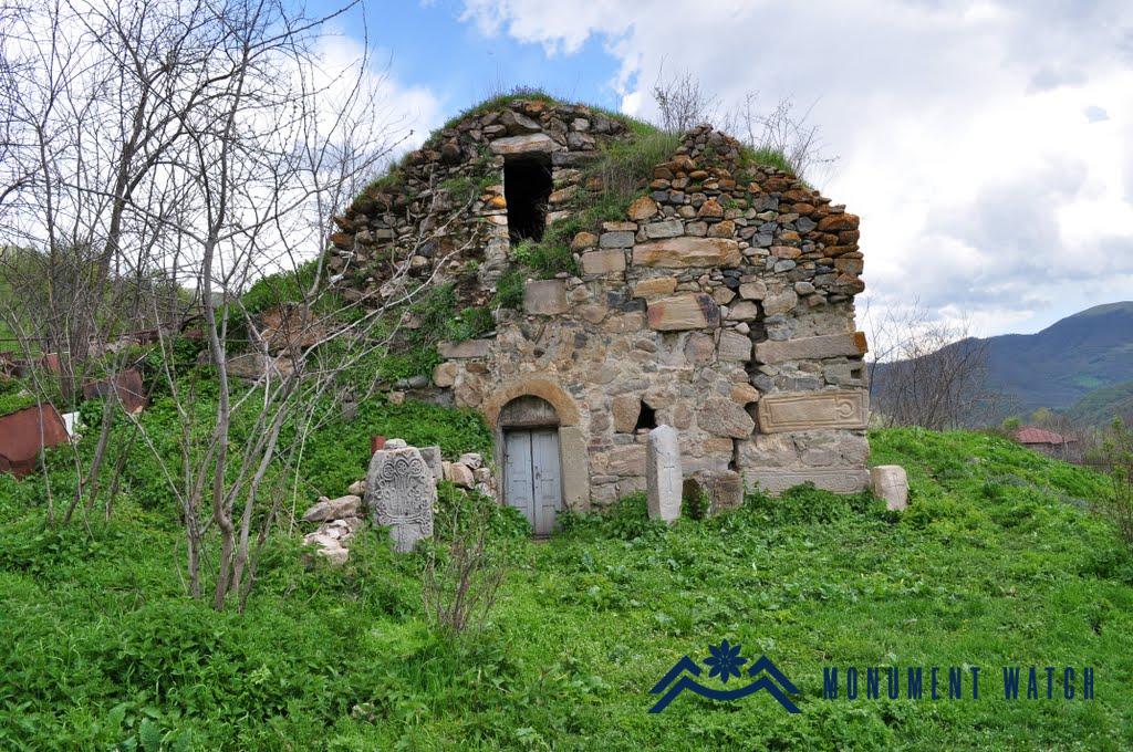
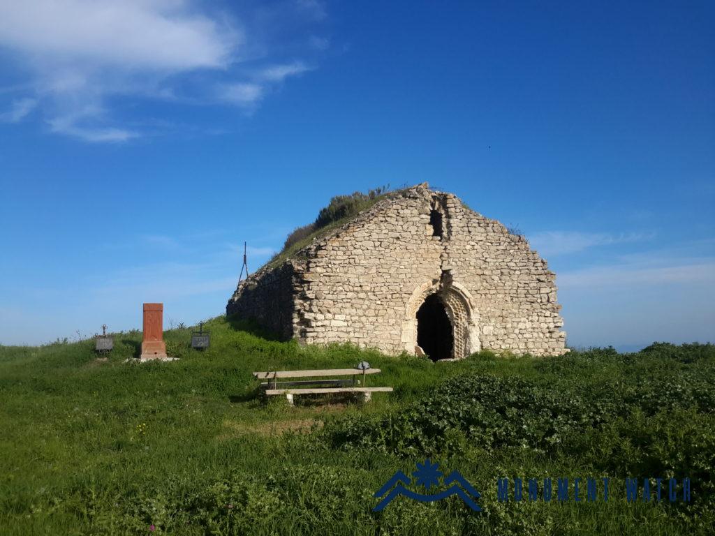
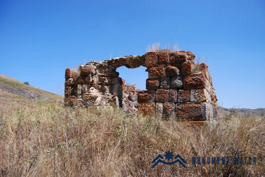
Location Katosavank Monastery is located in Kashatagh region of the Artsakh Republic (now under the control of Azerbaijan), 1 km north of the namesake settlement, on the bank of the Hochants tributary of the Hakari River (Fig. 1). Remains of a basilica church and outbuildings, a cemetery, and remnants of medieval settlements a little east and west have been preserved here. Historical overview There are no known historical data about Katosavank. The probable date of the structure, considering the architectural-compositional solutions and the date of the khachkars scattered in the area, can be considered as the 9th-11th centuries. Architectural-compositional examination The church is built of local rough basalt and lime mortar. Polished stones were used in the segments of building’s entrance, window sills, pilasters and the corners of walls (Fig. 2). The structure is a single-nave basilica with an inwardly accentuated altar on the eastern side with external dimensions of 16.70 x 6.90 meters (Karapetyan 2001, 154, Fig. 3). The thickness of the walls is from 1 to 1.1 meters. In the eastern part, large-sized vestries are attached to the northern and southern sides whose entrances are from outside and do not communicate with the prayer hall. The semi-cylindrical vault (it is completely absent) used to rest on arches rising on a pair of pilasters attached to the northern and southern walls. The church used to have three entrances: from the north, west and south (the latter is well preserved, Fig. 4). It has a preserved window on the southern wall. The vestries of the structure are relatively poorly preserved. The latter also used to have inwardly accentuated altars. The row of horizontal niches on the southern wall of the church suggests that the building had an adjacent hall with a wooden roof from the south (Fig. 5). A contemporary cemetery was spread around the building, from which several khachkars and gravestones of earlier and later periods have been preserved (Fig. 6). The condition before, during and after the war After the cessation of the operation of Katosavank, it mainly suffered during the years under Soviet Azerbaijan. In this period, some of the khachkars of the medieval cemetery were damaged and destroyed, including the inscribed khachkar of Father Grigor (Karapetyan 2001, 154, Fig. 7). Bibliographic examination Researcher S. Karapetyan in his book entitled “Armenian cultural monuments in the region of Karabakh”, also refers to Katosavank Monastery and identifies Katos with Getuz village of the Hakari land mentioned in the manuscript of the Gospel dated 1567 (Karapetyan 2001, 152).