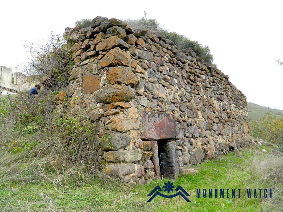
Location The church is located in Mirik village of Kashatagh region (Lachin region) of the Artsakh Republic. The village is located near the Mirik River, which adjoins the Aghavnaget River from the right side, at an altitude of 1440-1520 meters above sea level (Karapetyan 2001, 131). Historical overview The historical data about the village is rather scarce. The village was usually referred to as Merik, and in Soviet times it was referred to as Mirik (Karapetyan 2001, 131). Architectural-compositional description St. Astvatsatsin Church is located on the northern edge of the village, on the rock mass that dominates the village with its position (Fig. 1). According to the building inscription, it was built in 1682. By its plan, it is a three-nave basilica (Fig. 2). The walls of the church are lined with rough stone, and the cruciform columns and cornerstones are polished. There are gravestones dated different periods, fragments of khachkars as well as carved stones embedded in the walls (Figs. 3-9). They are both holistic and fragmented. The only entrance to the church is on the southern side, it is quite luxurious (Fig. 10). The building inscription of the church is on the entrance lintel (Fig. 11), it is slightly damaged: “I – paron (mister) Hakhnazar, built this St. Astvatsatsin Church in the memory of me and my parents: remember my father paron Sargis and my brother Haykaz in Christ. I – elder Najargul, gave 5 tumans to the church superintendent in the memory of me and my parents. We – the people of Mirik, gave 5 tumans to the holy church in the memory of us and our parents. In the year of 1130 (1682)” (Karapetyan 2001, 131).

Location The church is located in Hakaku village of Hadrut region of the Artsakh Republic. During the Soviet era, the village was part of Hadrut region of the Nagorno-Karabakh Autonomous Region. As a result of the 2020 war, Hakaku village, as well as the entire Hadrut region, are occupied by Azerbaijan. Architectural-compositional description St. Astvatsatsin Church is located in the center of the village (Fig. 1). It is a three-nave basilica with a volumetric-spatial composition, with a rectangular plan of 13.40X9.60 meters (Fig. 2). It ends in the east with a semicircular altar and rectangular vestries adjacent to it. The hall under the vaulted and gable roof is divided into naves by means of a pair of arches, which rest on two free and two pairs of pillars adjacent to the wall (Figs. 3, 4). The walls are lined with small and rough stones and lime mortar, the arches, door and window openings are made of hewn stones (Fig. 5). The only entrance to the church is in the south (Fig. 6). According to the building inscription, the church was built in 1621 (Mkrtchyan 1985, 119-120). The condition before and after the war The church was not damaged during the Artsakh wars. There is no information about the fate of the church after the occupation of Hadrut region.
Location Zorakhach Church is located in Kashatagh region of the Artsakh Republic (now under the control of Azerbaijan), 52 kilometers north of Berdzor, on the left bank of the Shalva tributary of the Hakari River, in the territory of Arakhish rural settlement (Fig. 1). Traces of a church, a medieval village and a cemetery have been preserved here. There is no bibliographic information about the monument. Judging by the architectural solutions of the church and the gravestones embedded in the walls (Fig. 2), the church is a structure of the 17th-18th centuries.

Location The church is located in Mets Tagher village of Hadrut region of the Artsakh Republic. During the Soviet era, the village was part of Hadrut region of the Nagorno-Karabakh Autonomous Region. As a result of the 2020 war, Mets Tagher village, as well as the entire Hadrut region, are occupied by Azerbaijan. The village is located on the left bank of the Ishkhanaget tributary of the Araks River, surrounded by forested mountains and gorges. The village is 1200 meters above sea level. Historical overview According to Shahen Mkrtchyan, in ancient times the village was called Kazh, as the village was founded by Daniel Kazhetsi. The village was mentioned by a number of names: Tagher, Nor Taghlar, Mets Taghlar. The name of the village is related to its consisting of several districts (Mkrtchyan, 1985, 102). Famous actor Vagharsh Vagharshyan, Marshal of the Soviet Union Aviation Armenak Khanperiants and others originate from Mets Tagher village. In addition to agriculture, handicrafts were developed in the village. In the 19th century, the village was actively engaged in the production of silk thread. Architectural-compositional description St. Amenaprkich (Holy All-Savior) Church is located in the center of the village (Fig. 1). It is a large single-nave basilica (Fig. 2), built in 1846. The vault and the vaulted arches, the tholobate, are accentuated sagittal, which gives a special vertical stretch to the prayer hall. The arches adjacent to the wall, the portal, the window niches and the baptismal font have a regular semicircular end. The church stands out also for its large prayer hall, which is covered with a 13-meter-wide single-span vault (Fig. 3). The main volume of the church is built of rough stones, and the portal, windows and vaulted arches are lined with polished stone. The only entrance is from the north, which was conditioned with the location of the church and the dense construction of the surroundings. Here, the building inscription is on the lintel (Fig. 4). The old khachkars placed in the walls of the church, various sculptural fragments, enable to suggest that stones and khachkars of another older building were used in the construction of the church or that the ancient church that had existed since ancient times was rebuilt (Figs. 5, 6, 7). Adjacent to the northern wall of the church there are garvestones (Figs. 8, 9, 10) and a magnificent chapiter (Mkrtchyan 1985, 104). The condition before and after the war The church was not damaged during the Artsakh wars, in 2012-2013 it was partially renovated and improved. According to a video posted on the Internet by Azerbaijani users in 2021, the entrance doors of the church were broken, the interior of the church was polluted, they tried to scratch and damage the inscription on the entrance lintel. The gravestones adjacent to the northern wall are damaged (Video made by the Azerbaijani military, where the entrance of the church, the damaged inscription on the lintel, the area adjacent to the entrance are seen, the video is taken from the following telegram channel (Azerbaijani source is unknown): https://t.me/ararathau/7365?single&fbclid=IwAR13yiYT8xv0mvqAguzz TjrJJSdhbE35JL3KfRczxTlpSpFqp3uCihSXk70).
Location Vakunis village is located in Kashatagh region of the Artsakh Republic, 46 km north of Berdzor, on the bank of the Shalva tributary of the Hakari River. The 17th century church is located in the central part of the village (Figs․ 1, 2).
Location The church of Arakhish is located in Kashatagh region of the Artsakh Republic (now under Azerbaijani control), 50 kilometers north of Berdzor, on the left bank of the Shalva tributary of the Hakari River, 1,5 kilometers south of the namesake village (Fig. 1). Traces of a medieval rural settlement, a church and a large cemetery to the south and west of it have been preserved here. There are no bibliographic data about the monument. Judging by the architectural peculiarities of the church, the early khachkars, the gravestones of the 12th-16th centuries (some of them are inscribed and dated), the settlement existed throughout the Middle Ages. Architectural-compositional examination The church (Fig. 2) is built of local raw stones, lime mortar, it is plastered inwardly. It is a single-nave vaulted hall with an accented horseshoe-shaped apse (Fig. 3).

Location Handaberd Monastery is located in Verin Khachen region of Artsakh (New Shahumyan region of Artsakh Republic, presently under the Azerbaijani occupation), on the high edge of the wooded slope of the mountain range in the southeastern bank of the Levonaget River. The monastery is located not far from Handaberd – the biggest and strongest fortress of the region. The fortress lacks any religious buildings and it is probable that the monastery served the religious needs of the inhabitants of the fortress. Operation According to one of the inscriptions, the main part of the buildings was built by Archimandrite David in 1276 around the older church on the site (Fig. 1). In the second half of the 13th century, during the Mongol dominion the foundation of a monastic complex was often laid by the clergymen themselves using their finance and even physical efforts. Thence, the architectural solutions and decorations are comparatively modest. These simple and plain buildings are on the one hand witnesses of the political, economic, cultural comedown and on the other hand a peculiar source to find out how the culture of the period voiced and tried to adapt to new hard conditions keeping the main elements of national identity. The main period of the operation of Handaberd Monastery goes back to the second half of the 13th century and to the 14th century. It was the period of the cruel Mongol dominion. The Mongol hordes not only invaded, plundered ruined the country and massacred the people but also made the armed forces of the conquered countries take part in their future invasions. The only intention of the period under these circumstances became struggle and survival, the only form of welfare was military service in the Mongol army. To fight for motherland’s sake in the Mongol army and to die in far-off countries – this was the fate of brave representatives of almost all noble families of Eastern Armenia. The cavalry was the main force of the period, the guarantee of the stability of the patrimonial possession and the existence of the Church. As it appeared after thorough investigations of the written sources, the Dopyan kin of Verin Khachen where Handaberd Monastery is located was one of the most famous followers of this way of life. Under these circumstances the main task of culture was to adapt to the changing conditions but keep Armenian identity, a mission which is best observed in Handaberd Monastery. Architecture The territory of the monastery was prepared beforehand; terraces were built from the south-east to the north-west on which buildings were erected. At present, the monastic complex consists of two groups of buildings (Fig. 2), the main one of which presents a cathedral with gavit, two chapels, a belfry in its west and a graveyard (Fig. 3).

Location The church is located in the center of Avetaranots village of Askeran region, in a low-lying area. Historical overview According to the inscription on the front stone of the door, the church was built in 1651 (Barkhutariants 1895, 75). Shahen Mkrtchyan mentions that the church had numerous gospels, crosses and other relics with inscriptions dated 1671, 1661, 1650, 1659 (Mkrtchyan 1985, 178). Architectural-compositional description The church is built of rough and hewn stones (Fig. 1). This three-nave, vaulted church, as mentioned by V. Harutyunyan is one of the largest in its type (external dimensions: 15.3×27.3 meters) and in absolute dimensions it is inferior only to the church of the great hermitage of Tatev (Fig. 2). The four pillars of the spacious prayer hall support the three parallel vaults, which are assembled under a gable roof. The garret-window opened in the central vault used to be crowned with a small-sized rotunda, which has not been preserved. On both sides of the main altar above the vestries there are “lodges”, which similarly to St. Gevorg Church of Noragavit, with their two arched openings face the prayer hall, but have a stepped entrance from the stage (Harutyunyan 1992, 401). The condition before, during and after the war Before the war, the church was completely standing, only the rotunda on the gable roof was missing. During the 44-day war, there were hot battles in the area of Avetaranots village, but there is no information whether the monument was damaged during the battles. There is also no information about the monument after the war. Bibliographic examination The first written information about the church is reported at the end of the 19th century by Bishop Makar Barkhudaryants (Barkhutaryants 1895, 75), whose testimonies about the dated inscription of the church are much valuable. The information and research on the monument are modest. Information about the architectural style of the church is presented by V. Harutyunyan (Harutyunyan 1992, 401), and some historical facts – in the works of Sh. Mkrtchyan (Mkrtchyan 1985, 177-178). Bibliography Barkhutaryants 1895 – Barkhutaryants M., Artsakh, Baku. Harutyunyan 1992 – Harutyunyan V., History of Armenian Architecture, Yerevan, “Luys” Publishing House. Mkrtchyan 1985 – Mkrtchyan Sh., Historical and architectural monuments of Nagorno Karabakh, Yerevan, “Hayastan” Publishing House.

Location The church is located in the center of Hochants village of Kashatagh region, at an altitude. Historical overview Hochants is one of the most famous villages of Kashatagh canton with a rich historical past. The first mention of the village as Hunchak is evidenced in the list of villages of Aghahetch canton compiled by St. Orbelyan (Orbelyan 1912, 372). The village is also mentioned at the beginning of the 17th century, when two bishops who had left the Tatev hermitage founded the Hochants hermitage in its vicinities (Davrizhetsi 1896, 260) and at the end of the 17th century, when the Armenians of Karbi village clashed with the nomadic Kurds at the very village (Zakaria 1870, 9). The first information about the church dates back to the late 19th century, when an abandoned church in the depopulated Armenian village was used by the Kurds as a fodder store (EM 1898, 50). Back in the 60s of the last century, a slab was preserved in the western wall of the church with the following inscription: “In the name of God, I – Hekaz, gave a quarter of our own oil mill, which was mine, as a waqf to Stepanos…” (CAI 5, 194). It becomes clear from the inscription that the church is called St. Stepanos. Architectural-compositional description There is no exact information about the time of construction of the church. Judging by its architectural type, it was probably built in the second half of the 17th century (Fig. 1). It is a single-nave, vaulted structure built of raw stones and lime mortar. It has a main altar, a sole entrance opened from the south, windows opened in four facades that widen inwardly and a baptismal font in the northern wall, several khachkars are embedded in the walls. The external dimensions are 13.40*8.15 meters. In the last decades of the Soviet Union, the church building served as a bakery for the village, for that purpose separate segments of the church were altered, other buildings were attached to it from the south and west (Karapetyan 2001, 164) (Fig. 2-3).
Location The monastery is located in the middle of Tandzut and Moshatagh villages of Kashatagh region (Lachin region) of the Artsakh Republic, on the right-bank rocky hill of the Aghavnaget River (Fig. 1). Historical overview There is no historical evidence about the monastery. According to the assumption of monument expert Samvel Karapetyan, the name of the monastery may be associated with the treatment of the disease mknatam (a fungal disease of the skin: ringworm) (Karapetyan 2001, 138). Architectural-compositional description The church is built of polished stones and has architectural and compositional features typical of the 12th-13th centuries. It is a single-nave vaulted building and resembles more a chapel rather than a church (Fig. 2). The only architectural decoration is the frame of the western entrance and the crown of the window (Fig. 3). The walls of the church lack any inscriptions. The roof is covered with semi-circular covering slabs.

Location The church is located in Hak (Minkend) village of Kashatagh region (Lachin region) of the Artsakh Republic. The village is located on the left bank of the Aghavnaget River, 1720-1800 meters above sea level (Karapetyan 1999, 128). Historical overview The village is first mentioned by the 13th century historian Stepanos Orbelyan as a village located in the north-eastern part of historical Syunik – a village of Aghahetchk canton bordering on historical Artsakh, which was tributary to Tatev Monastery (Hakobyan, 1960, 209). It paid 15 units in taxes to the monastery (Orbelyan, 1910, 516). The folk etymology of the name Minkend (Turkish: literally a thousand villages) is linked to a legend, according to which it was the 1000th settlement destroyed during the invasion of Tamerlane (Ghanalanyan, 1969, 172). The village was inhabited by Armenians until the beginning of the 18th century, later it was depopulated of Armenians. Instead, Kurds settled here. Only in 1841 did the Armenian population again return to the village, when the Armenians who had moved from Khndzoresk village settled in the village thus living in a separate district. The Armenian population suffered significantly during the 1905 Armenian-Tatar clashes, and in 1918 the village was finally depopulated of Armenians. During the Soviet years, the population of the village presented Turkified Kurds (Karapetyan 2001, 129-130). Architectural-compositional description St. Minas Church is located in the center of the village (Figs. 1, 2).
Location Amutegh is located on the namesake mountain (1315 m) in the southern part of the mountains of Artsakh, on the left bank of the Hakari River, north of Urekan village in Kashatagh region of the Artsakh Republic (presently Ghubatli region of the Republic of Azerbaijan) (Figs. 1, 2).
Location Shalva village is located in Kashatagh region of the Artsakh Republic, 53 km to the north from Berdzor, on the bank of the Shalva tributary of the Hakari River. St. Poghos-Petros Church dated to the 17th-18th cc. is located in the southern side of the village (Figs․ 1, 2).
Location The monastery is located in Hadrut region, in the valley of the Ishkhanaget River, left to the road leading from Togh to Varanda (Fizuli), on a hill separated from the plain. It is located near the villages of Jrakus, Hogher and Kyuratagh. Historical overview There are no accurate records preserved in historical literature on the foundation and activities of the monastery. The fact that there used to be a monastic complex is evidenced by the remains of the foundations of the surrounding walls, cells of the congregation, pilgrim rooms still preserved on the hill. The present church (Figs․ 1, 2, 3) is the only structure left standing from the former monastic complex, which was rebuilt in 1742 by the order of Melik Yegan of Dizak and his father – Archimandrite Ghukas, and the residents of the surrounding Gyumush, Chima and Hogher villages (Mkrtchyan 1985, 112).
Location Kataro Monastery (Fig. 1) is the highest-situated monument of the Artsakh Republic. It is located in the northwestern part of Hadrut region, on the peak of Dizapayt mountain, at an altitude of 2478 meters (Fig. 2).
Location Medieval Armenian writing centres – Mos and Apahen settlements of Tsar canton of Artsakh province of historical Armenia Major which are mentioned in ancient manuscripts and epigraphs, were located in the intermountain trough of the Mos tributary of the Dutkhu stream of the Trtu River. A small-sized church called Karmir Vank is still partially standing on a separated hill on the right bank of the Mos River, between Apahen (Abdullaushagh) and Mos (Mozkend), in the territory of Fatalilar rural area.
Location The church of Varazgom is located in Kashatagh region (Lachin region) of the Artsakh Republic, between Merik and Ghushchi villages, on the left side of the Aghavnaget River. No bibliographic data have been preserved on the church, it lacks any epigraphs. The church is in an emergency state, the spire of the drum and the southern wall have collapsed, there are cracks (Figs. 1, 2).

Location Spitak Khach Monastery is located on a hill in the village of Vank, directly northwest of Hadrut city in the Artsakh Republic. History The name of Spitak Khach monastery is related to a legend, according to which after the martyrdom of St. Gregoris, his patriarchal staff and the pectoral crystal cross were originally kept in Amaras, where his remains were buried. After the desolation of Amaras, these relics were moved to Gtchavank, and the crystal white cross to the monastery near Hadrut, from which it gained its name of Spitak Khach (White Cross). Sargis Jalalyants, who visited here in the middle of the 19th century, writes in his travel notes that the cross “was visited by numerous pilgrims to sacrifice rams and calves. ․․․In honor of this cross, a church was built here, it was turned into an episcopal see and an independent diocese was allocated. Here I saw the kontakions of four catholicoses for the establishment of this see, namely Hovhan, Yesayi, Nerses and Simeon, [which were given] to the descendants of priest Srapion, who from the generation to generation were and are now the overseers of this church and cross. The elders tell that due to carelessness, it happened that the handkerchiefs with which the cross was kept wrapped were burned, with which also the cross, but the cross was not damaged in any way, only a small crack appeared inside, after which the cross was silver-plated and carefully kept (Jalalyants 1858, 263). The exact date of the foundation of the monastery is not known, the oldest of the preserved inscriptions, engraved inside the church, under the khachkar of the northern arch, is dated to 1333: “I – Sirok, erected this cross for my father Khutlap in the year of 1333” (Barkhutaryants 1895, 68). Further inscriptions testify to the renovations of the church.
Location St. Stepanos Church is located in the south-western part of Togh village in Hadrut region of the Artsakh Republic, near the old cemetery (Fig. 1).
Location Holy All Savior Ghazanchetsots Church of Shushi is located in the central part of the city, 1378 m above the Karkar valley. Thanks to its elevated location, it dominates the entire plateau (Figs. 1, 2).